Everest Base Camp: Before I Couldn’t

Morning sun illuminating Ama Dablam peak

Why I Came

My fascination with the Himalaya and Mount Everest is probably rooted in my first mountain experience.

At 22, still young, naïve and utterly unprepared, I signed up for a student weekend adventure to the Amphitheatre escarpment in the northern Drakensberg.

With a hopelessly overweight backpack, slick soled tennis tackies, Pep rain jacket and an injured knee, I trudged into the unknown.

Scaling the 30-metre chain ladders later in gale-force wind and near-freezing temperatures tested my nerve. Visibility dropped to almost zero.

We set up camp on the escarpment and bunkered down for the night.

At last, I was semi-dry and warm.

Or so I thought.

During the early morning hours, our borrowed tent tore in the violent winds. Water seeped inside, but I stayed dry.

I knew there was a good reason to pack a stretcher for the trip.

So, we learn.

The vast landscape stunned me: slow to cross in distance and altitude, and deadly to the unprepared or injured.

My Drakensberg experiences from 2005-2011 piqued my interest in mountaineering.

High-altitude mountaineering stories by Messner, Bonington, Krakauer, Boukreev, Venables, Viesturs fascinated me.

I, however, had no ambition to attempt Everest. I nevertheless had a burning desire to one day stand between the Himalaya’s giant peaks.

Eventually, that opportunity came.


How I Ended Up Going

My father passed away at the young age of 64 in 2016.

One day, I saw online a photographer from Lydenburg, Des, showcasing photographs from a previous trip to the Indian Himalaya. He was planning another trip, this time to Everest Base Camp.

Des referred me to Nomadic Adventures, who informed me that a group of six hikers had already booked for the October 2017 EBC trek.

Drawn to a group of fellow Lowvelders and photographers, I went ahead and booked my spot.

There were two options. The first was to turn around at Nangkartshang Peak, near Dingboche, at 5,083 metres. The second was to continue to Everest Base Camp at 5,364 metres, about 40 kilometres further in total distance.

Four of the seven, me included, chose the shorter option.

Today, I can’t think of one sound reason why I would have done that.

Weight would be at a premium, with the flight to Lukla imposing a 16 kilogram luggage limit.

I felt confident about avoiding altitude sickness. I reasoned that living most of my life between 1,400 and 1,800 metres and having hiked and slept above 3000 metres in the Drakensberg would stand me in good stead.

The challenge: a 130-kilometre trek, with an altitude gain of 2,519 metres from Lukla to Everest Base Camp.

Porters would carry most of my gear. I would carry a day pack with warm clothing, water and my camera. I looked forward to a lighter load, having become accustomed to carrying 18–20kg packs in the Drakensberg.

Although I maintained a high level of fitness through regular squash and distance running, I had chronic back issues.


Philosophy

I often thought about something my father used to say when speaking about the future:

“As ons die lewe hou.”

If we live.

His own father and father-in-law had died unexpectedly at 45 and 65, both while apparently healthy. As a result, my father made a point of doing the things he enjoyed rather than putting them off until retirement.

That philosophy resonated with me.

At 38, I hoped I could do it. I didn’t know if I always would.

As the trip drew nearer, I couldn’t shake the nagging feeling that I needed to go all the way to EBC.

My original decision had been influenced by Des, who had experienced the Himalaya and would only go as far as Dingboche. I started to question it.

“Why go halfway around the world only to stop 20 kilometres short of EBC?”, I asked myself.

Fortunately, the tour operator was able to accommodate my extended itinerary.

The stakes were now raised.


The Mountain Starts Fighting Back


Kathmandu to Lukla

With tourist visa in hand, I enter Nepal and immediately sense a chaotic energy.

I spot my scribbled surname on a tiny cardboard in a sea of quizzical faces in the arrival hall.  “Namaste!”, greets my chauffeur with a beaming smile.

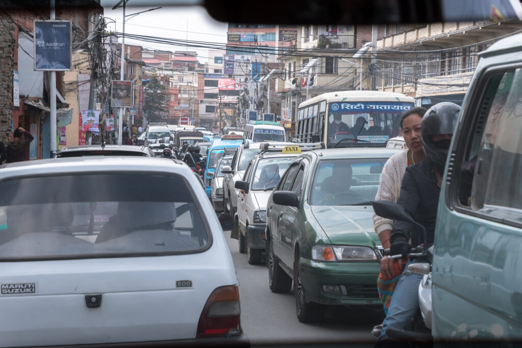
Nothing in life has prepared me for this Friday afternoon rush-hour drive from Tribhuvan International Airport to my hotel in the Kathmandu tourist suburb of Thamel. On these dusty streets, pedestrians, canines, goats, motorbikes, scooters, rikshaws and buses perform a death-defying dance.

With frail nerves I arrive at The Thamel Eco Resort. It’s a neat, friendly hideaway from the frenetic streets of Kathmandu.
 

On the second morning, our hiking group is finally together, and we leave for the airport. A nervous excitement fills my stomach.

The day’s plan? Catch our morning flight to Lukla, then hike 8 kilometres to Phakding.

Due to the weight limitation, I wear in the stifling heat my wind proof jacket, boots, hiking gear and camera bag. Every pocket is crammed with necessities to reduce my bag’s weight.

We arrive at a chaotic Kathmandu airport. Flights to Lukla are backlogged for hours due to bad weather and maintenance on the runway.  We wait seven long hours in the overcrowded, claustrophobic departure hall.

At 3pm our flight number is finally shouted. We scramble through the boarding gate, onto the bus, and then board the twelve-seat Twin Otter plane. We strap in while the pilots run their checklists.

Then the solitary air hostess boards and announces matter-of-factly,

“Unfortunately, the flight is cancelled. Bad weather at Lukla. Will you please disembark”

We all stare at her in disbelief, waiting for her to follow with, “Only joking!”

No humour on this flight.

She instructs us again to disembark and with a collective groan we unbuckle and leave the aircraft.

We’ve effectively lost a day if we can’t make it to Lukla today. A cancelled flight doesn’t mean you’re first in line the next day. You fall to the back of the queue.


Helicopter

Nga-wang, our trek guide, suggests a Plan B. It’s already late in the day, but miraculously he finds a helicopter charter.

After a lot of bargaining, it’s an additional US$200 per person.

We’re checked in again and driven to the opposite side of the airport. This time, we’re required to climb onto the scale.

With the sun relentlessly slipping towards the horizon we still wait for an available pilot. I’m starting to resign myself to the fact that we’ll have to return to our hotel in Kathmandu for the night. It’s a sickening thought.

Suddenly we are summoned to a dragon emblazoned Eurocopter standing on the ramp. There’s only space for six passengers, which means Wayne, our tour leader, and Nga-wang must stay behind. They’ll try again tomorrow.

The pilot, Eric, jumps into his seat. By the look of it he’s had a long day. He requests a flight clearance to Lukla. “Negative”, comes the reply from the Control Tower in our headsets. We look at each other. “Not again!” He requests Ramechhap and is fortunately cleared.

Ramechhap is east of Kathmandu and closer to Lukla. We won’t sleep in Lukla tonight, but at least we’ll be out of Kathmandu.

Climbing out over the outskirts of Kathmandu we follow the Trisulu River valley. Visibility is extremely hazy.

Steep mountains rise from the valley floor. These are supposedly only the Himalayan foothills, and I’m already floored by their sheer scale.

Villages lie scattered along the river and on the slopes.

Twenty-five minutes later, well after sunset, we land at Ramechhap. After securing the helicopter we look for a place to sleep.


The next morning, we depart after sunrise. Slowly we make our way out of the haze as we gain altitude towards Lukla, 2740 metres above sea level. The B3’s climb performance makes light work of the full load.

Eric points at some landmarks. Then snow-covered peaks appear through the clouds and haze, towering at least 3000 metres above us. The sheer scale of the Himalayan peaks are hard to comprehend. I sit in awe.

A big part of the Everest experience is the notoriously demanding landing at Lukla, so I’m thankful for the helicopter’s much slower and safer approach speed.


Lukla

It is still early morning, and the temperature drop from Ramechhap to Lukla is a noticeable 15°C. We meet our second guide Asmit and set off to the Himalaya Lodge situated close to the runway.

What to do, though, as our lead guide and tour leader is still absent? After losing half a day, we can’t afford to lose another. Instead of the eight kilometres to Phakding we’ll hike thirteen kilometres to Jorsalle. 

Before setting off, I make my first acquaintance with the squat toilet. I’m struck by the realisation that I’ll have to confront this formidable opponent every day.

The water drum and wastepaper bucket are positioned at different points around the hole, requiring a bit of manoeuvring to reach each one.

The procedure is a time-consuming, balancing-act rigmarole.

The idea of having the runs at night in sub-zero temperatures, while navigating this obstacle course, is frightening.

And so, relieved to finally be in the mountains, I take the first step of the trek.
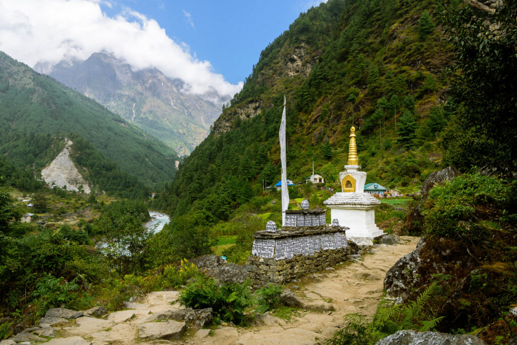
 

The path follows the Dudh Koshi River, crossing numerous suspension bridges along the way. We soon cross paths with a yak train, obediently trudging along beneath their heavy loads.

I’m taken aback by the mountains’ sheer vertical cliffs. We pass through numerous small villages, all offering accommodation and food.

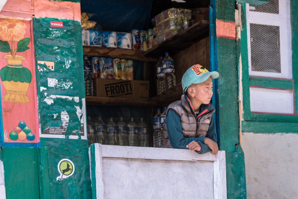
Friendly Nepali faces greet us along the way. Kids play in the village passages, some even helping in their family-run curio shops. The western influence is everywhere to see. Mountaineering down jackets are worn by most locals.
 

We stop at Phakding for lunch and tea, the first of many on the trip. I settle for a warm, refreshing orange tea. It will become my drink of choice throughout the trek.

We’re constantly advised not to race, but walk at a leisurely pace.

Late afternoon we reach our accommodation in Jorsalle. The tea house is situated on the river. The rushing glacial water makes a tremendous noise. I have my last shower here and we get our first taste of dhal bat.

During the night Wayne, Nha-wang and our three porters finally reunite with us. They had quite a day.

Next morning we continue up the valley and soon we get to the famous Hillary suspension bridge. It looks much higher than what I could remember from pictures on the internet. I dare not look down as I cross the swaying suspension bridge, 410 feet above the river below. After I cross, a group of trekkers is forced to backtrack on the bridge when a herd of yaks decide it’s their turn to cross too. Some trekkers foolishly attempt to shimmy past the beasts on the narrow bridge — something I wouldn’t attempt.
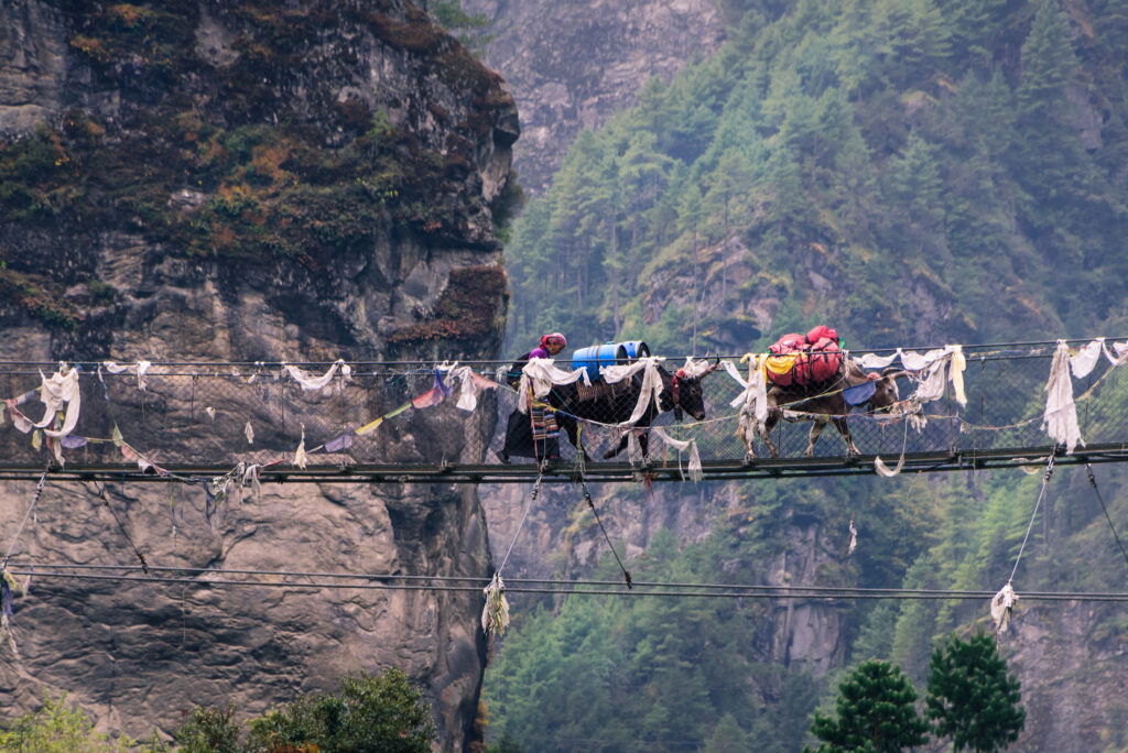
 

We start the gruelling 700 vertical metre climb to Namche Bazaar and suddenly I start to feel the effects of altitude. The going is slow and I’m regularly out of breath. Umberto, already now established as the strongest climber, pulls me up the hill like a magnet. I know I must slow down, but the competitor in me can’t concede defeat.

A while later we come to a clearing in the trees, and there in the distance, a mere 20 kilometres away as the crow flies, Everest’s summit dome peaks over the Nuptse Ridge. 
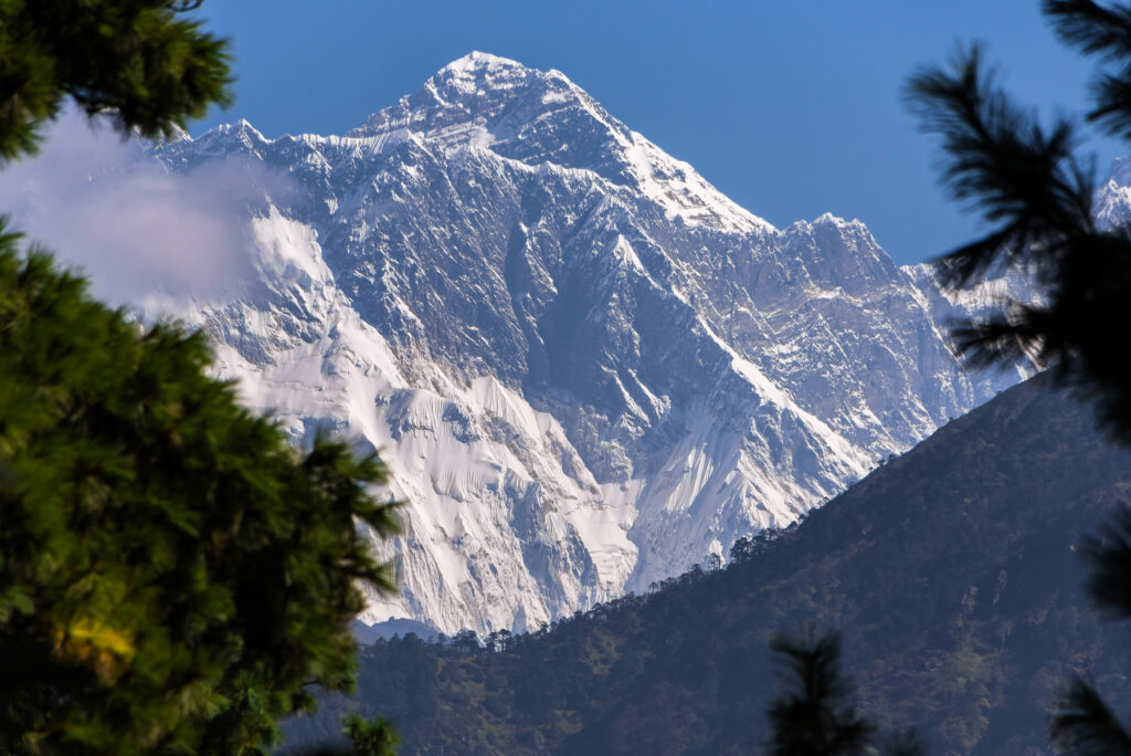
 

Mid-day, we reach Namche Bazaar, our overnight stop where we’ll acclimatize for a day at 3400 metres and buy the last bits of gear we need. This is officially the highest I’ve hiked and boy, am I feeling the effects.


Above 4000 metres

It’s a cold, dreary and overcast day in Namche. From the town centre to our tea house is a steep set of probably 50 steps. This becomes an obstacle throughout the day.

The next morning, we set off for Deboche, further up the valley.

After an hour’s hiking, the morning peak-hour traffic of tourists starts to fan out, and I begin to relax and enjoy the views of Thamserku Peak across the river.

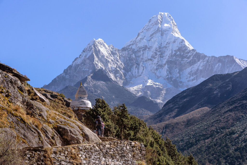
Soon, Ama Dablam comes into view. With its soaring ridges and steep faces, this beautiful mountain is sometimes referred to as the “Matterhorn of the Himalayas”.

We pass the Tenzing Norgay Memorial stupa with Lhotse and Everest in the background.

High Mountain Bakery Café near Khumjung reveals panoramic mountain views. Surrounded by famous peaks, I bake in the sun while sipping fresh tea.

Afterwards, we descend through a forest to the river. I wince at the thought of giving up these precious metres in altitude.

I brace myself for the climb to Tengboche. Only two kilometres long with a 500-metre elevation gain, it feels endless. I use the regular breathing stops to photograph magnificent Kangtega across the valley.

At last, we top out at Tengboche Monastery, but are too late to receive a blessing from the monks.
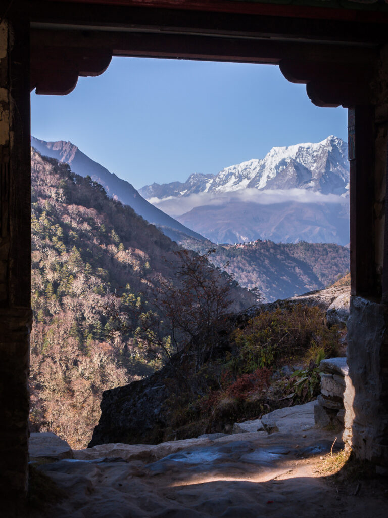
 

Food and warmth are promised at Paradise Lodge, so we make our way down the hill to Deboche.

I struggle to sleep. Shallow breathing and gasping awakenings make rest elusive. At 3,700m, it’s my first real taste of altitude insomnia.

At dawn we set out for Dingboche — an eight-hour trek with 700 metres of altitude gain. The trail winds through moss-draped rhododendron forests, crosses suspension bridges, and eventually opens into alpine meadows beneath the watchful gaze of Ama Dablam.
 

Beyond the tree line

At 4,000m we cross the tree line. Every step is slower, every breath shorter, and the scenery keeps getting better. Avalanche scars from a recent earthquake snake down the slopes, and the air grows thin and crisp.
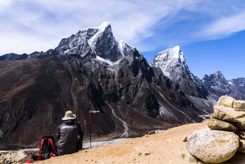
 

We arrive in Dingboche as the sun sets — a picturesque village surrounded by Ama Dablam, Taboche and Lhotse. The Moonlight Lodge is the best of the trek so far — warm hosts, western toilets (sort of), and rooms drenched in afternoon light.

The next morning, Des, Hein, Chris and Asmit must be up at 4am to climb to the highest viewpoint of their trip.

I make use of the acclimatization day to wash clothes. I’m sure my aroma gives the yaks a run for their money.

We’re treated to a spectacular sunset. Lhotse’s golden-lit southern face reveals itself through the swirling clouds.
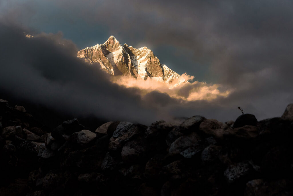
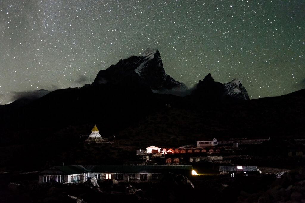
 

The next morning, we say goodbye to Asmit and our three departing comrades. Secretly I’m thankful to have changed my itinerary to EBC. I’m not ready to descend yet.

We head up to Lobuche.

Fatigued, I will my feet to move. A sniping wind blows into our faces. Another 600-metre elevation gain lies in store. Looking back, I’m astonished that it took us a full day to complete the 12 kilometres.
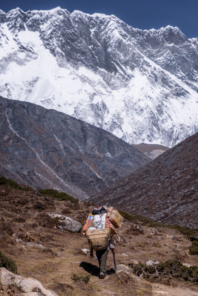
 

I’m mesmerized by near-vertical Cholatse, rising 1,700 metres from the turquoise Chola Lake. My eyes are constantly drawn to it.

We lunch at Dughla. The next challenge stares us right in the face: the short but steep 250-metre Thukla Pass to the Everest memorial and the start of the Khumbu Glacier moraine.
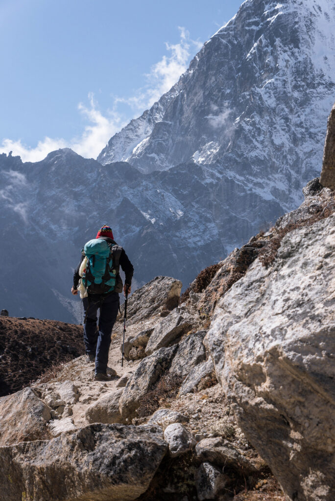
 

To scale any uphill at this stage requires some serious self-motivation. My intention to walk 20 steps before a rest break is reduced to five. The gradient is brutal.

Umberto seems unfazed and relaxed as he scrambles past me. I convince myself it’s because he doesn’t carry a camera.


The memorial is a sobering place.

A solemn cluster of stone chortens and plaques, it’s dedicated to climbers and Sherpas who lost their lives on the mountain.
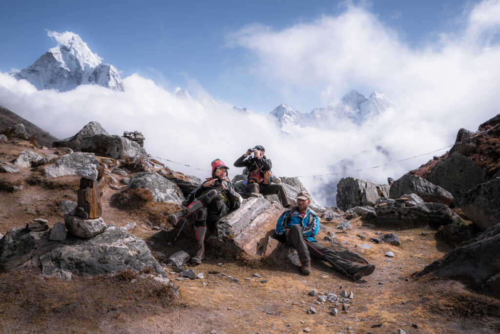
 

Soon the cold wind hurries us onwards, and we enter a new world: the Khumbu Glacier. It consists of rock, ice, glacial water and precious little oxygen. It’s stark and menacing. Apart from ant-like humans on the trail, no life seems to exist here.

Eight kilometres ahead, an amphitheatre of chiselled rock and ice signals the turning point of our trek and the border between Nepal and Tibet.

Two hours later, we plod into Lobuche’s underwhelming Hotel Peak XV.

After sharing a room with Des for the first section of the trek, Wayne is my new roommate. He is a colourful, affable character, always busy with something. It’s comforting to have an experienced leader on the team. Always joking, few things get him down. His positivity really helps me in these trying conditions.

The building feels makeshift. Every movement and sound seems amplified in the tiny room. The toilet cubicles are a wet, messy affair. The tearoom is stuffy and cramped. Water is expensive. Internet connection is non-existent.

Maybe I’m not feeling too well?

I feel irritated and restless.

I’m too tired to even take off my hiking boots or wet clothes, never mind photograph the surroundings. I can’t fall asleep. Exasperated, I finally force myself out of bed to have a miserable wet-wipe wash before night falls.

As I lie in bed after dinner, I can’t help but yearn for my creature comforts. First prize would be a decent toilet and uninterrupted sleep. But first, we need to climb higher…


Everest Base Camp

After another fitful and freezing-cold night, we leave the next morning for Gorak Shep, the last village before we reach EBC.

It’s a long day of rock hopping. Hikers crowd the single-lane footpath.
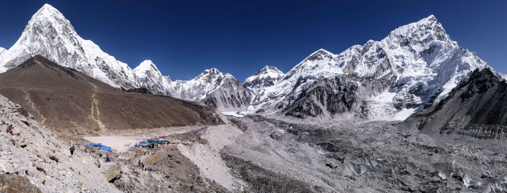
 

After lunch at Gorak Shep, I’m dog-tired as we set off for EBC. The process of stopping, unzipping the camera bag, pulling the camera out, taking a photograph and putting it away again seems unnecessary. At the time, it doesn’t bother me.

I’m lethargic, with a throbbing headache. Foolishly, I blame it on dehydration. Water is expensive in this part of the world.

Wayne, Ryan and Umberto seem to be enjoying themselves. I’m not.

After painfully slow progress, we finally make it to EBC.
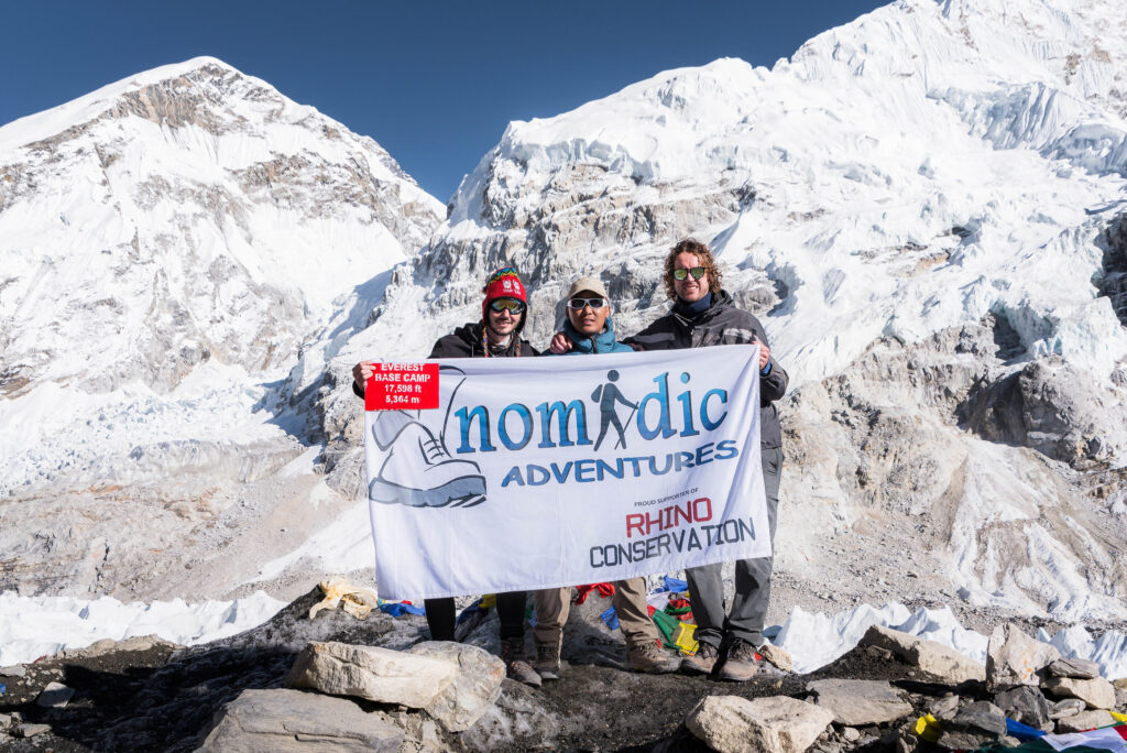
 

As it is not climbing season, there aren’t any tents to be seen. Situated adjacent to the Khumbu Glacier, I look across the glacier towards the fearsome Khumbu Icefall. It occurs to me that if you were to climb Everest, the climb only starts now.

We pose for photos. The moment feels more symbolic than triumphant. A Japanese couple gets engaged.

The human body is not designed to live here. Without fanfare I head back to Gorak Shep.
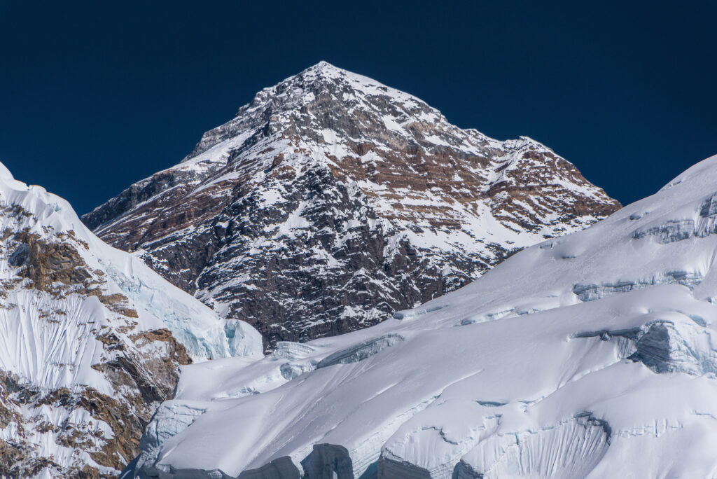
 

Wayne and I are allocated a windowless two-by-three-metre room, barely big enough to stand in and with no space to unpack our bags. Outside lies an extraordinary mountain landscape. We can’t see any of it. After some protest, we’re upgraded to a better room. We’re grateful.

We tuck in early, as we are to get up at 4am to climb Kala Patthar. It will be our high point of the trip. We’re hopeful of getting a sunrise view of Everest.


Kala Patthar

It’s freezing, yet I feel like I’m about to combust.

“Five steps, then a break,” plead my lungs and heart. After two breathless steps, I have an overwhelming urge to rest again.
 

“Keep going. Stay with Nga-wang,” spins like a merry-go-round in my mind.

Each step illuminates more rock in front of my feet in the beam of my head torch. Beyond it, the light is swallowed by pitch-black darkness.

A shiver runs down my spine at the thought of having to endure a lonely night out here in the immense Himalayan landscape.

I look at my watch. Our trekking party of five left Gorak Shep an hour ago, and we have another hour before sunrise. I’m starting to worry that I made a mistake following blindly in Nga-wang’s footsteps. His pace is relentless.

I’m breathing hard, but fortunately my legs still feel strong.

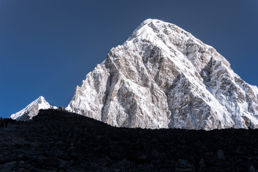
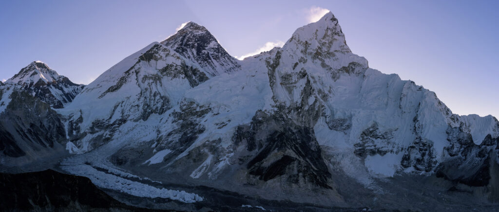
Then, as first light breaks, a surge of adrenaline re-energises me. Every passing minute reveals a little more of the surrounding landscape. To the east, I can see the silhouettes of Nuptse and Everest. Ahead, the immense pyramid-shaped dome of Pumori towers above us.

I want to photograph the scene, but the low light would mean setting up my tripod. With the temperature so far below freezing and time running out before sunrise, I decide against it and push on.

Suddenly, I see small figures on the ridge of Kala Patthar.

At more than 5,500 metres, this popular Everest viewpoint will be the highest place I have ever stood on Earth.

Finally, I make it there.

Real estate for a tripod is at a premium. My fast pace up the hill is rewarded with a small patch of even ground before the crowd squeezes in.

410 metres higher, I suddenly have a completely different viewpoint of the mountains we passed on the way up. To the east, the now-familiar peaks of Ama Dablam, Taboche and Cholatse are set against the skyline.

I dare not shed a tear. It will freeze my eyelids.

To operate the camera, there is no option but to lose the mittens. The -9°C temperature, excluding wind chill, quickly numbs my fingers.

At last, it’s sunrise time, but the Everest massif blocks the sun’s long-awaited warmth for another half hour.

I see the South Col for the first time and am thankful to view it from a safe distance. This saddle between Everest and Lhotse, at almost 8,000 metres, is also Camp 4 on the southern route to the summit of Everest.

The bottom of the death zone.

It looks like hell.

Spindrift is blown at incredible speed across its width, backlit by the rising sun.


Within a few minutes, it becomes unbearable to take any more photographs.

It’s time to head down to a warm tea house and breakfast at Gorak Shep.

To my surprise, many more hikers pass me on their way up the mountain. Much simpler not to be a photographer. But this morning’s effort was worth every photograph.


Getting Home

But first, we must cross the Kongma La Pass, situated between Lobuche and Dingboche.

Buoyed by our EBC and Kala Patthar success, we set off early to find the trail through the Khumbu Glacier. It is a brutal walk, with every step a balancing act of boulder hopping. Soon we reach the glacial pools in the moraine.

A frustrating hour ensues. We can’t find a path through the pools. There is a spot that looks jumpable, but no one is willing to take the leap of faith.

While scrambling over the rocks, I suddenly feel a sharp pain in my left Achilles. I can still walk, but I immediately know it’s a problem. I still have 50 km to walk to Lukla.

Time is ticking. With no route found through the moraine, the conversation shifts to bailing out via Dughla to Dingboche, bypassing the time-consuming climb.

I have no problem with that. The last thing I want is to be stranded on a high pass at night.

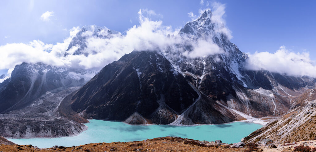
The extra time gives us the opportunity to detour to a viewpoint above Chola Lake. It is the trip’s most picturesque lunch spot. The near-vertical Cholatse behind the turquoise Chola Lake creates a dramatic landscape. The large lake was formed when rock avalanches from Cholatse and Taboche created a dam wall.
 

I stay as long as possible before heading lower to Dingboche.

Back at Dingboche, I don’t care about money anymore. I have my first shower in eight days.

It’s glorious.

I’m still craving a good night’s sleep, which I hope will come soon at lower altitude.


The Way Back

The next morning, we practically fly down the mountain. With every step down, I can feel the air becoming easier to breathe.
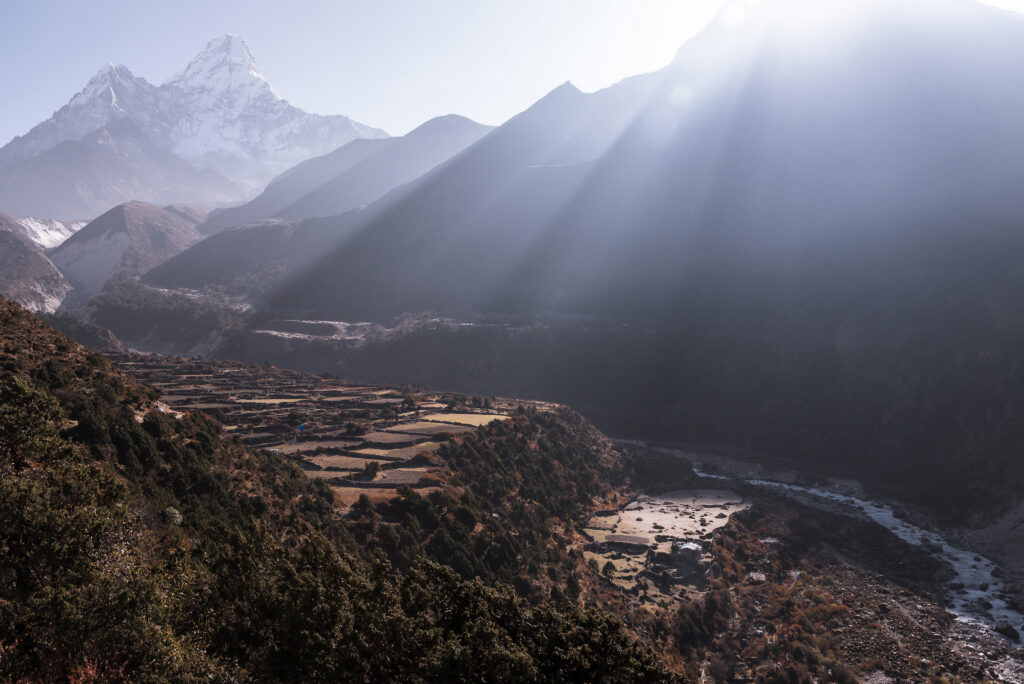
 

My state of mind has changed. Without the tension and adrenaline of moving towards EBC, I feel distinctly flat. Although the scenery is still breathtaking, the hike feels like a slog.

Wayne organised an extra-day excursion to Ama Dablam Base Camp from Pangboche. Although I’m tempted to join them, I sit it out to rest my heel. There is still a good 25 km to Lukla.

It’s a long day at the tea house. I make my way down to the river to take a few long-exposure shots.

The next morning, I’m up before sunrise to get a last pre-dawn look at the mountains. I follow the line of headlamps on Ama Dablam’s summit slope. What incredible views those climbers must experience.
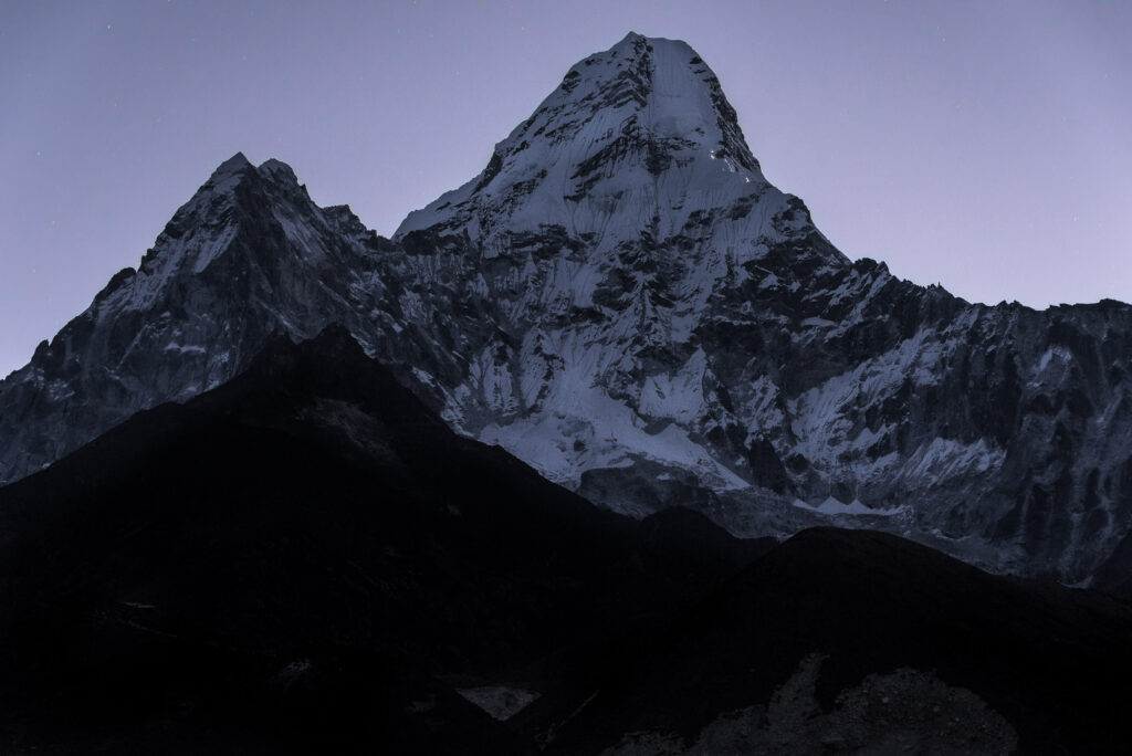
 

Suddenly, Wayne comes running at me.

“You locked me in!” he protests.

“What? I closed the door; I didn’t lock it,” I retort.

“No,” he replies. “There’s an outside lock. When you closed the door, it locked, leaving me trapped inside. I also wanted to take photos.”

He proceeds to copy some of my photo ideas. I brush it off, but he clearly doesn’t see the funny side of it.

The walk down to Namche is relaxed. I practically run up the difficult stairs I encountered a week before in Namche. A week ago, they were an obstacle. Now I barely notice them.
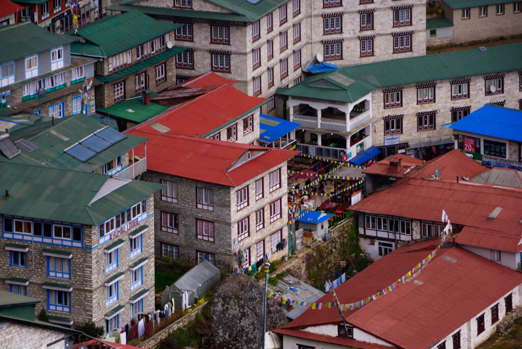
 

Wayne and I somehow win the presidential room lottery. It is luxuriously spacious in Himalayan terms and has panoramic views of Namche Bazaar. Half forgiven, I join Wayne for his obligatory coffee and cake, and that evening, Ryan, Umberto and I have a celebratory Guinness at what claims to be the highest Irish pub in the world.

We’re slowly moving back to civilisation.

Under 3,500 metres now, I also have the best night’s sleep in over a week.

The next day we tackle the last stretch out to Lukla. True to our trip’s form, it won’t end without a hiccup. There’s weather about, and the flights are delayed. We spend another frustrating and anxious day in the Lukla terminal.
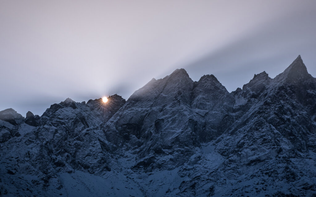
 

Lukla Airport

This gives me ample time to study the well-drilled Lukla operation.

After an arriving aircraft parks, with one engine still running, both pilots, looking the part with their aviator Ray-Bans and bomber jackets, exit the aircraft to smoke one cigarette while waiting for the handlers to unload and load the passengers and cargo.

I don’t see any fuelling facilities, which explains why the pilots can stand on the apron smoking while the aircraft is being turned around.

Then they board, start the dead engine, obtain clearance, line up and depart.
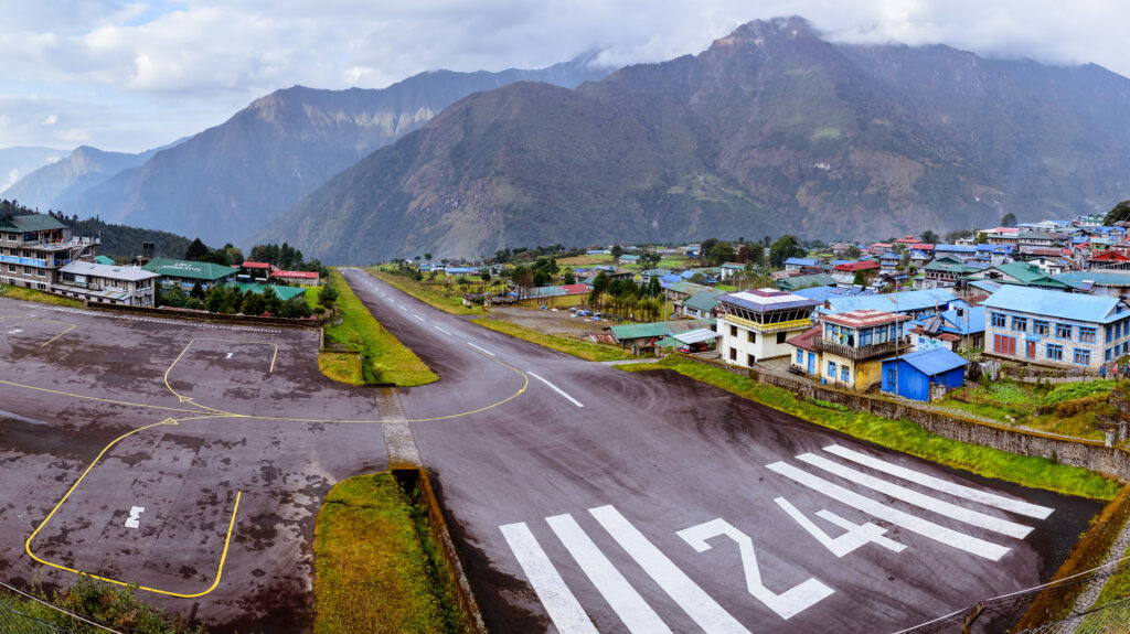
 

Much later, our flight number is called, and we finally get our chance on the Tara Air Twin Otter. I try not to think too much about the take-off risks at an airport often described as among the world’s most dangerous.

We line up on the runway. At full brakes, the pilot advances both throttles to full power for about five seconds to confirm the engines produce the advertised power. The aircraft strains against the brakes.

Then, when the brakes release, we shoot down the 12% gradient runway.

My hands clench around the seat. At last, we get airborne, but not a second too late. I see the steep drop-off at the end of the runway to the valley below.

The danger is not over. As we climb, we start to flirt with clouds. With this kind of terrain around you, flying into cloud seems suicidal.

Thankfully, we soon enter clearer skies.


What does it even mean?

Nine years later, I often think back to the “before I can’t” philosophy.

The short answer? I’m so grateful to have done it when I did.

Covid struck in 2020, during which I met my life partner. Then life happened.

I’m still relatively young, but my back condition has deteriorated. I now think twice before attempting physical activities.

Would I like to hike the Himalaya again? Of course.

Would I be able to do it? Maybe.

The clock is ticking.


Lily Pond Country Lodge: A Tranquil Retreat Near Plettenberg Bay

Pool area at Lilypond Lodge
Introduction

Nestled between indigenous forest and tranquil wetlands near Plettenberg Bay, Lily Pond Country Lodge offers a peaceful retreat where luxury and nature exist in perfect harmony. During my recent photography assignment at this beautiful property, I was immediately struck by the serenity of the surroundings and the lodge’s seamless connection to the natural landscape.

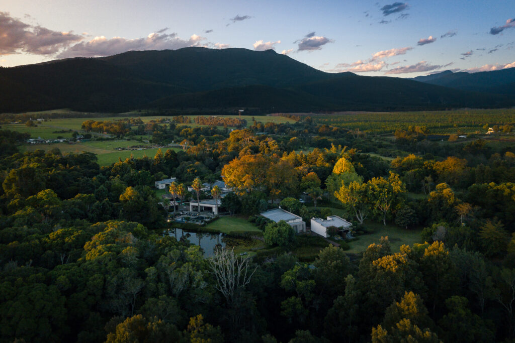
Aerial view of Lilypond Lodge

A Hidden Gem Near Nature’s Valley

Lily Pond Lodge is located just a short drive from the picturesque village of Nature’s Valley. It is ideally positioned for guests seeking both relaxation and adventure along the Garden Route. Lush vegetation, towering trees, and abundant birdlife surrounds the property, creating an atmosphere of complete tranquility from the moment you arrive.

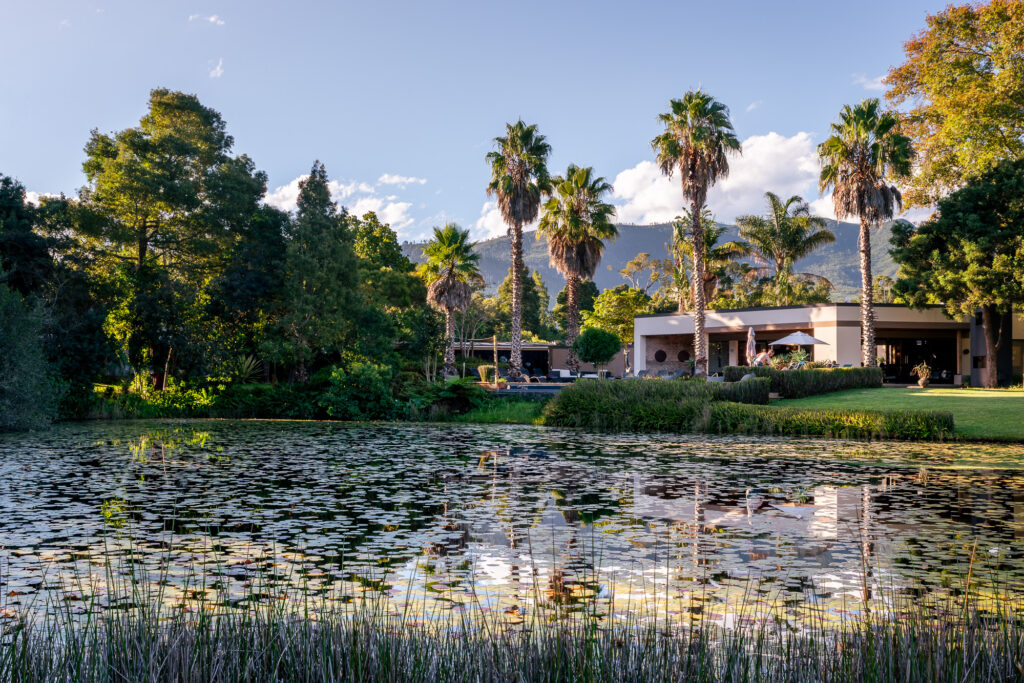
The pond at Lilypond Lodge

Tranquil Surroundings and the Famous Lily Pond

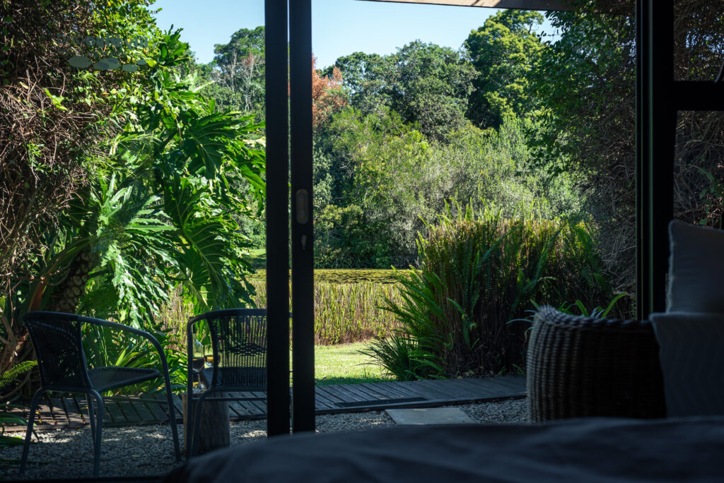
One of the lodge’s defining features is the stunning lily pond that gives the property its name. Reflecting the surrounding greenery and changing light throughout the day, it provides a beautiful focal point and enhances the sense of calm that permeates the entire estate. Whether enjoyed from the lodge’s pathways, decks, or guest suites, the natural beauty of the pond is ever-present.

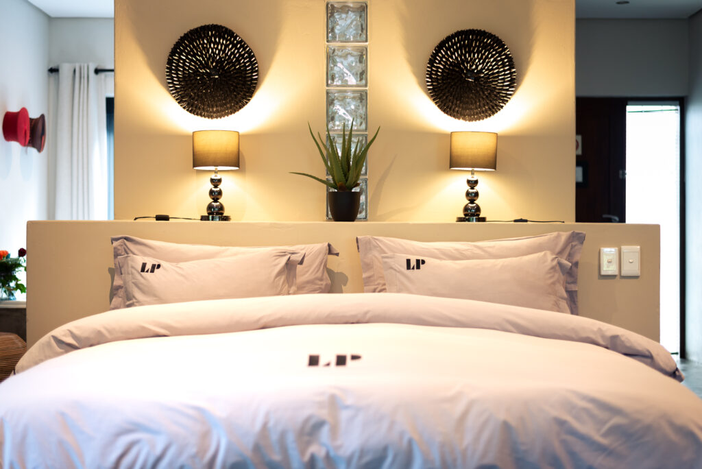
One of the rooms at Lilypond Lodge

Comfortable Luxury in Nature

The accommodation combines comfort and elegance, with spacious suites thoughtfully designed to complement the surrounding environment. Large windows and private outdoor spaces allow guests to fully appreciate the spectacular natural setting while enjoying modern comforts and luxury amenities.

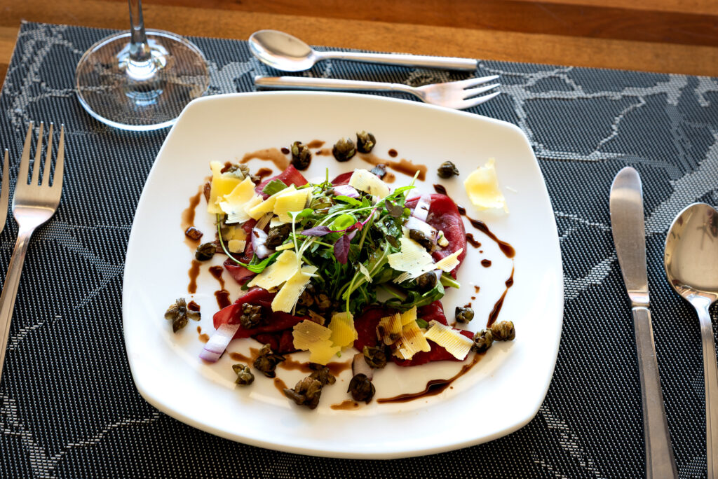
Plate of salad at Lilypond Lodge

Warm Hospitality and Memorable Dining

Hospitality is at the heart of the Lily Pond experience. Throughout my visit, the staff were warm, welcoming, and attentive, ensuring that every guest feels at home. Their genuine friendliness contributes significantly to the relaxed atmosphere that makes the lodge such a special destination.

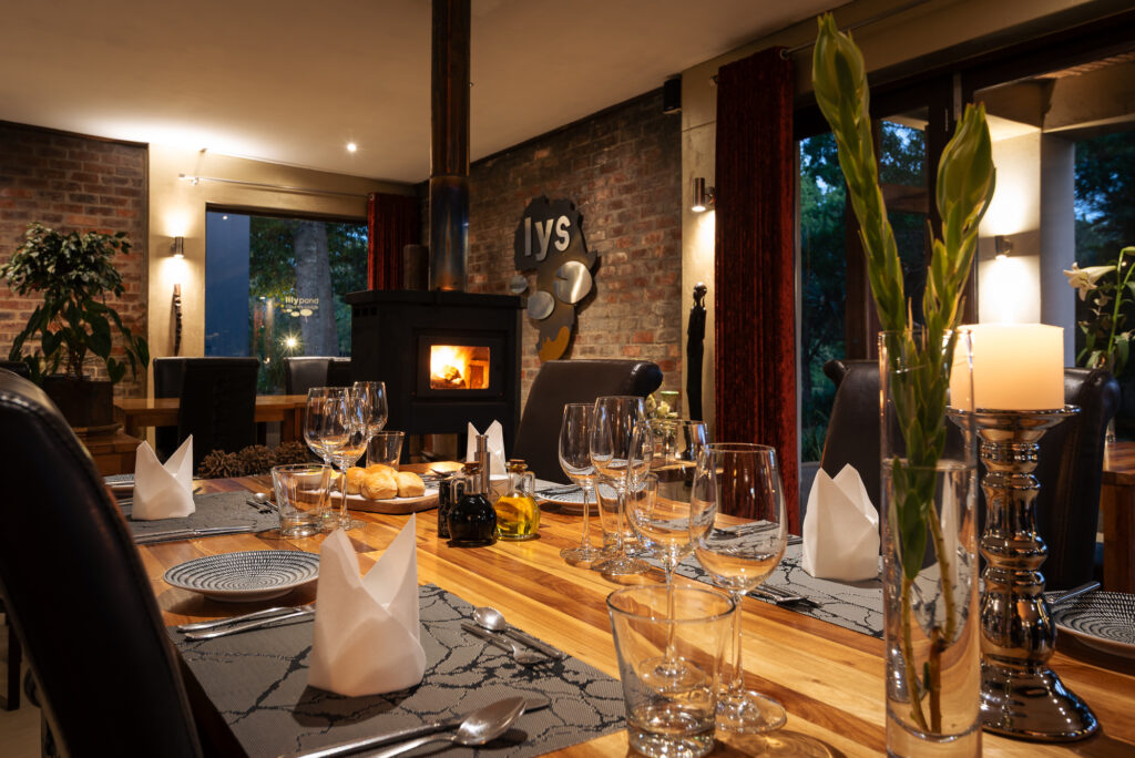
Evening ambience at Lilypond Lodge

Relaxation and Rejuvenation at the Spa

The culinary experience is equally impressive. Guests can enjoy delicious meals prepared with care, offering a memorable dining experience in a peaceful setting. For those looking to unwind completely, the lodge’s relaxing spa provides the perfect escape, offering treatments designed to rejuvenate both body and mind.

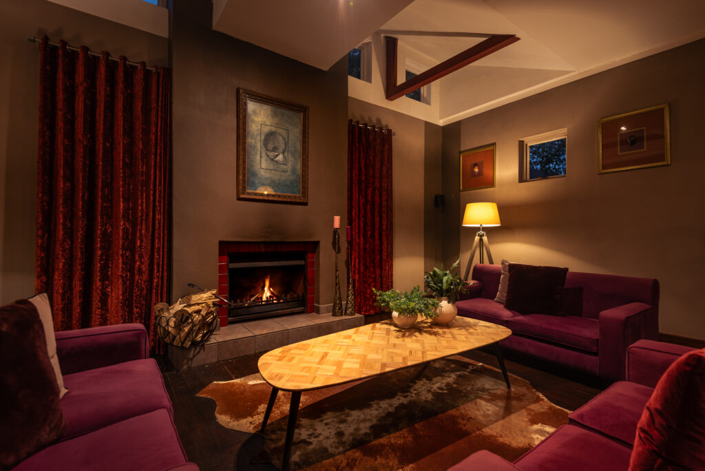
Lounge with fireplace at Lilypond Lodge

A Peaceful Garden Route Escape

Lily Pond Country Lodge is a destination that invites guests to slow down, reconnect with nature, and experience the quieter side of the Garden Route. My photography session captured only a glimpse of its charm, but the memories of its beautiful surroundings, exceptional hospitality, and peaceful ambience will remain long after the visit.

View from a room at Lilypond Lodge

Comfortable room at Lilypond Lodge

Watch video I filmed and edited for Lilypond Lodge


Garden Route Game Lodge Safari & Luxury Accommodation

Drone view of the Garden Route Game Lodge complex.
Introduction

Nestled along the N2 between Albertinia and Mossel Bay, Garden Route Game Lodge offers visitors the perfect combination of luxury accommodation, exceptional hospitality, and unforgettable wildlife experiences. During my recent visit, I had the opportunity to photograph this remarkable destination and capture the beauty that makes it one of the Garden Route’s premier safari lodges.

Reception area at Garden Route Game Lodge.

A Scenic Safari Destination on the Garden Route

One of the first things that strikes you upon arrival is the spectacular setting. Surrounded by rolling landscapes and magnificent mountain views, the lodge provides a peaceful retreat where guests can relax and reconnect with nature. The recently completed reception area creates a welcoming first impression. It blends modern comfort with the warm atmosphere that characterises the lodge.

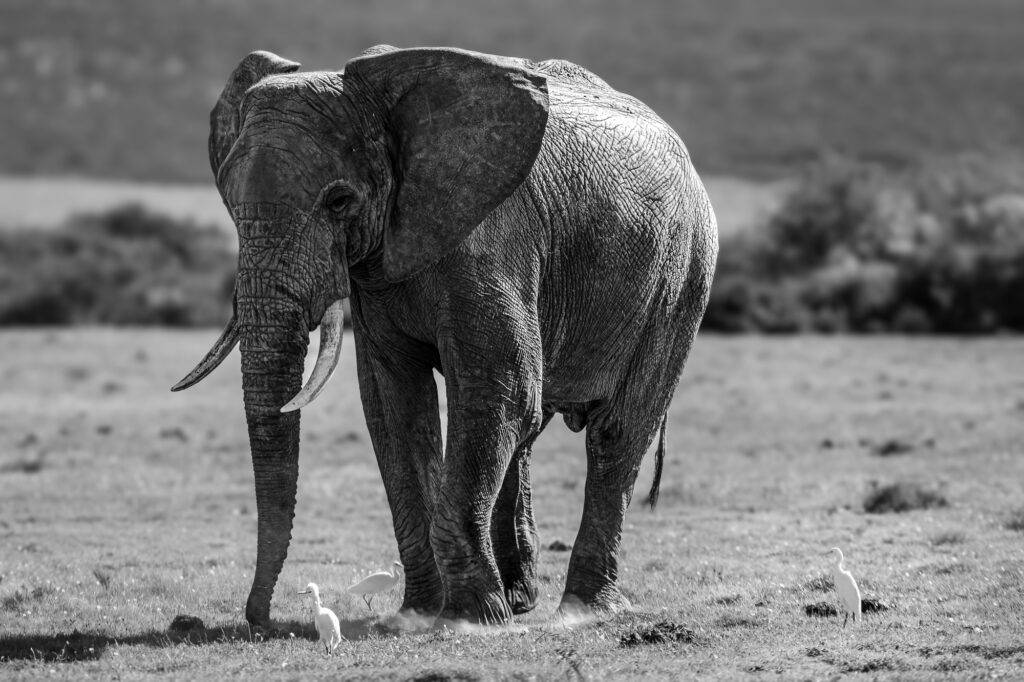
Elephant kicking grass at Garden Route Game Lodge

Big Five Game Drives and Wildlife Encounters

Garden Route Game Lodge is home to the Big Five, offering guests the chance to encounter lion, elephant, buffalo, rhino, and leopard during professionally guided game drives. These safari experiences provide incredible photographic opportunities while allowing visitors to appreciate the diverse wildlife that inhabits the reserve. Morning and afternoon game drives are led by knowledgeable guides who share their passion for conservation and the natural environment.

Chalet room at Garden Route Game Lodge

Luxury Bungalows and Chalet Accommodation

Accommodation at the lodge caters to a variety of travellers seeking comfort and luxury. The beautifully appointed luxury bungalows and chalets offer spacious interiors, stylish décor, and tranquil surroundings. Whether visiting as a couple, family, or group, guests can enjoy a relaxing stay while remaining immersed in the African bush experience.

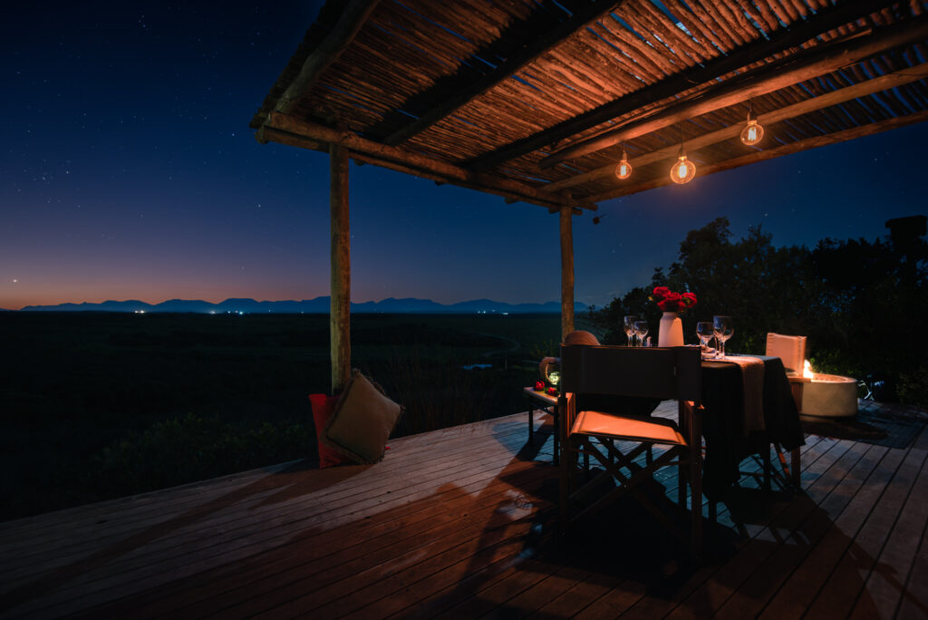
Dinner for two at Garden Route Game Lodge

Exceptional Dining and Hospitality

Dining is another highlight of a stay at Garden Route Game Lodge. Guests are treated to exceptional meals prepared with care and attention to detail. The quality of the food complements the overall guest experience, creating memorable moments around the table after a day of wildlife viewing and exploration.

What truly sets the lodge apart, however, is its friendly and attentive staff. Their genuine hospitality ensures that every guest feels welcomed and cared for throughout their stay.

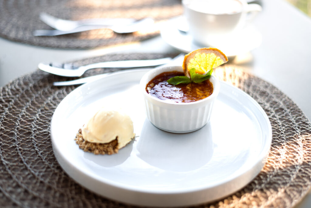
Dessert served at Garden Route Game Lodge

Conclusion

From breathtaking mountain vistas and Big Five safaris to luxurious accommodation and outstanding service, Garden Route Game Lodge delivers an authentic and memorable safari experience in the heart of the Garden Route.

Bungalow room at Garden Route Game Lodge

Watch video I filmed and edited for Garden Route Game Lodge

Ilita Lodge : Ocean Views and Coastal Luxury in Great Brak River

Front facade of Illita Lodge
Introduction

In March, I had the opportunity to photograph the beautiful Ilita Lodge in Great Brak River, one of the Garden Route’s most scenic destinations. Perched on a hillside with breathtaking panoramic views of the Indian Ocean, the lodge offers a peaceful retreat where guests can relax and enjoy the natural beauty of the South African coastline.

Sea views of the Indian ocean from Ilita Lodge

From the moment you arrive, the setting leaves a lasting impression. Expansive ocean vistas stretch as far as the eye can see, creating a sense of tranquility that defines the entire property.

Interior of room at Ilita Lodge

Spacious and Comfortable Accommodation

The lodge’s accommodation is equally impressive. The rooms are spacious, tastefully furnished, and designed with comfort in mind. Large windows allow natural light to flood the interiors while showcasing the magnificent ocean views. Every detail contributes to an atmosphere that feels both luxurious and welcoming.

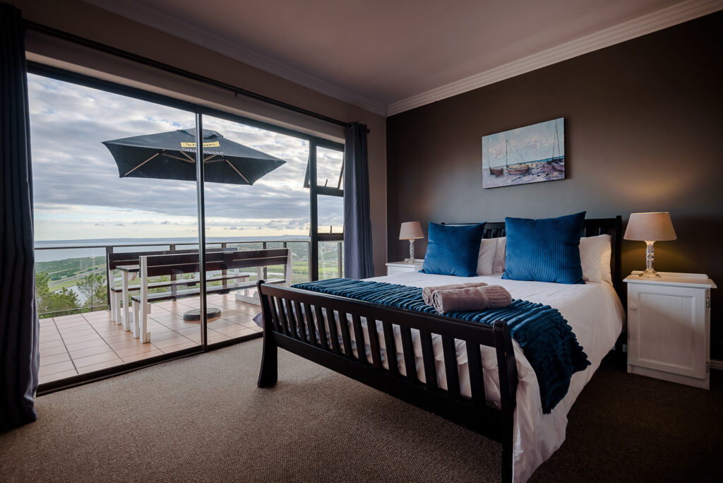
Interior of room with view over Ilita Lodge at Great Brak.

Warm Hospitality and Friendly Service

One of the highlights of my visit was experiencing the warm hospitality of the staff. Their friendly and attentive service helps create a relaxed environment where guests feel genuinely welcome. It is clear that great pride is taken in ensuring every visitor enjoys a memorable stay.

Pool and deck area overlooking Great Brak at Ilita Lodge

A Perfect Venue for Weddings and Conferences

Beyond leisure travel, Ilita Lodge is also a versatile venue for special occasions and business events. The property offers an elegant setting for wedding ceremonies, with the ocean serving as a stunning backdrop for couples exchanging their vows. The combination of beautiful scenery, spacious grounds, and comfortable accommodation makes it an attractive choice for destination weddings.

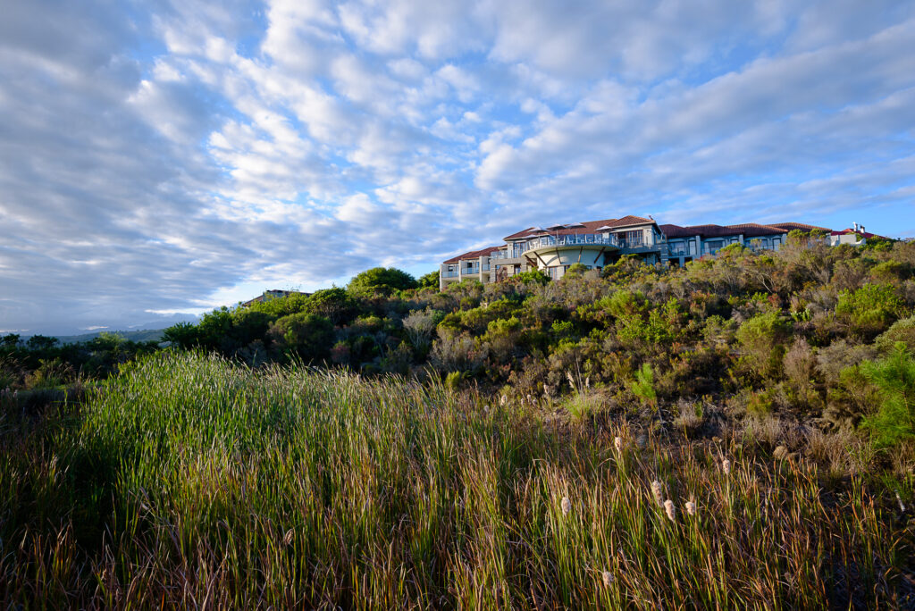
Ilita Lodge exterior

For corporate clients, the lodge features a well-equipped conference facility suitable for meetings, workshops, and team gatherings. The peaceful surroundings provide an inspiring environment away from the distractions of the office.

Conference room at Ilita Lodge

Conclusion

Photographing Ilita Lodge was a pleasure, not only because of its striking location but also because of the welcoming atmosphere that defines the property. For travelers seeking ocean views, comfortable accommodation, exceptional service, and a venue for weddings or conferences, Ilita Lodge offers a memorable Garden Route experience.

Wedding ceremony area at Ilita Lodge.

View from room towards Great Brak at Ilita Lodge.


A Truly Outstanding Memory


Beacon Island Hotel at dusk
A few minutes after I took this phone photo, the dolphins made their appearance.


A truly outstanding memory isn’t always captured in a photograph.

The sun set a quarter of an hour ago. Our kids run ahead on the beach and the faded pink sky hums with the quiet thrill of doing something unordinary, like walking barefoot on cool sand at dusk. Seeing the kids laugh, jump, exclaim, point, and goof around beats a regular school night at home.

Why do we go on holiday? To escape the grind, to rest, to explore, to make memories? To take photos of our wonderful experiences and share them with the world? Or simply to be there, in the moment, enjoying the now? If you blink, you might miss the show, and the now.

Suddenly, a pod of dolphins appears just beyond the shore break. In the fading light, it’s beautiful, surreal, and it doesn’t cost a cent.
Impulsively I look for my camera but remember I only have my phone with me. “No use, it’s too dark,” I scold myself.
I decide to just watch. I breathe and I let it happen.

“Wait, they’re coming closer to shore!” the eldest exclaims.
“They’re surfing!” his sister shrieks.

Surely, I think, already awed, these dolphins aren’t about to jump from a wave?

But then, it happens.
The “exceeds expectations” moment becomes a truly outstanding memory. A dolphin rockets from the front of the wave with the grace of a ballet dancer and the wild joy of a wire-haired fox terrier reunited with its people.

Conditioned to a world of replays and instant gratification, I almost expect it to happen again. Or for a slow-motion version to magically appear, but there’s no replay. No photograph and no entry for National Geographic.

Then, just like that, the pod slips into the blue yonder, and the beach forgets. Life returns to normal, as if it never happened.

I have many photos from this holiday, but none match this moment. So, does a memory without a photograph count?

I think they count more.


View my landscape gallery

https://www.sa-venues.com/things-to-do/gardenroute/lookout-beach/


The Cape West Coast

Driving along the Cape West Coast is an evocative experience that stirs a deep connection to nature and serenity. As the road hugs the rugged coastline, the breathtaking views of the Atlantic Ocean crashing against rocky shores and sweeping sandy beaches awaken feelings of awe and tranquility. The vibrant wildflowers, particularly during spring, paint the landscape with splashes of color, evoking joy and a sense of renewal. The salty breeze carries whispers of the sea, while the distant calls of seabirds remind travelers of nature’s unfettered beauty.

Each curve in the road unveils a new vista that inspires reflection and gratitude, making the journey not just a passage through a stunning landscape but a heartfelt communion with the raw, powerful essence of the South African coast. This drive along the Cape west Coast is a poignant reminder of the delicate balance between nature’s grandeur and the quiet moments of introspection it inspires.


Cape West Coast
Langebaan Beach

Langebaan, a charming town situated on the west coast of South Africa, offers an abundance of outdoor and leisure activities for visitors and residents alike. This picturesque destination is nestled around the shores of a beautiful lagoon, providing stunning scenery and endless opportunities for exploration.


Cape West Coast
Mykonos Beach, Langebaan

Water Sports Enthusiasts will rejoice at the variety of activities on offer. Langebaan is renowned for its world-class sailing and kayaking, with numerous rental shops and schools available to cater to all skill levels. Visitors can also indulge in paddleboarding, windsurfing, or even take a leisurely boat trip across the lagoon.


Langebaan Beach

Nature lovers will appreciate the numerous hiking and bike trails that crisscross the surrounding landscape. Explore the Langebaan Nature Reserve, which is home to an array of wildlife, including over 200 bird species, small mammals, and numerous indigenous plant species. For the more adventurous, take a guided hike to the top of the nearby mountains to enjoy breathtaking views of the lagoon and surrounding area.


Preekstoel, West Coast National Park

Leisure activities abound in Langebaan, with an array of cafes, restaurants, and shops to explore. Visit the vibrant town center, where art galleries, craft shops, and boutiques showcase local talent and craftsmanship. After a day of exploring, relax at one of the many excellent restaurants, where fresh seafood and delicious South African cuisine await.


Cape West Coast
West Coast National Park

For a unique experience, visit the nearby West Coast National Park, where visitors can explore the park’s diverse landscape, including fynbos, succulent gardens, and salt pans. Here, one can spot a variety of wildlife, including Cape grysbok, bat-eared foxes, and the majestic Cape eagle.

Mykonos Harbour, Langebaan

With its perfect blend of natural beauty, outdoor adventure, and leisure activities, Langebaan is an ideal destination for families, couples, and solo travelers alike. Its laid-back atmosphere and friendly locals make it an unforgettable experience that will leave you eager to return.

Cape West Coast
Club Mykonos, Langebaan


Paternoster is a charming fishing village nestled along the West Coast of South Africa, renowned for its stunning white sandy beaches and vibrant ocean views. This picturesque destination provides an abundance of outdoor and leisure activities that cater to a variety of interests, making it a perfect getaway for nature lovers and adventure seekers alike.

Paternoster

One of the most enticing aspects of Paternoster is its breathtaking coastal scenery, which is ideal for leisurely walks and scenic hikes. The 30-kilometer-long shoreline offers ample space for beachcombing, swimming, and sunbathing. Visitors can explore the nearby Cape Columbine Nature Reserve, a haven for hiking enthusiasts. The reserve boasts well-marked trails that lead to the iconic Cape Columbine Lighthouse, from which hikers can enjoy panoramic views of the rugged coastline and the Atlantic Ocean.

For those interested in water sports, Paternoster is a popular spot for kayaking, sailing, and stand-up paddleboarding. The calm waters of the bay provide perfect conditions for both novices and experienced paddlers, while the surrounding marine life, including dolphins and seals, adds an exhilarating touch to the experience. Fishing enthusiasts can also take advantage of local charters that offer deep-sea fishing opportunities, where one can expect to catch a variety of fish species such as yellowtail and snoek.


Paternoster

Birdwatching is another rewarding activity in the Paternoster area. The region is teeming with an array of bird species, including pelicans, African penguins, and various shorebirds. Birdwatching tours can be arranged for those passionate about avian life, allowing them to immerse themselves in the rich biodiversity of the local ecosystem.

Additionally, Paternoster is known for its exceptional culinary scene, with numerous seafood restaurants lining the coast. After a day of outdoor activities, visitors can unwind by indulging in freshly caught seafood while enjoying the stunning sunset views. The local cuisine emphasizes sustainability, incorporating freshly harvested ingredients that resonate with the region’s maritime heritage.


Paternoster

Art enthusiasts will also find enjoyment in Paternoster, as the village boasts an array of galleries and shops showcasing the work of local artists and artisans. Visitors can explore unique art pieces, crafts, and merchandise, offering an authentic taste of the locality.

We stayed at the Blue Moon in Paternoster. It has an excellent location as it’s close to restaurants and the beach. It’s also on the peninsula, which makes it feel a bit more secluded.

In summary, Paternoster is brimming with outdoor and leisure activities suited for all types of travelers. From water sports and hiking to birdwatching and culinary experiences, this charming coastal village is the perfect destination for those wanting to connect with nature while enjoying the serene beauty of the Cape West Coast.


Wolf Alice | In The City Music Festival

Wolf Alice @ Emmarentia Dam, Johannesburg

07/10/2018


Getting there

The day has finally arrived. Today I’ll see Wolf Alice live not on Youtube but in real life. I leave White River at 9 am. The drive to Johannesburg is long and boring. Can’t I be there already!

Four hours later I find parking at the eastern entrance to the Johannesburg Botanical Gardens. Music drifts towards me on the breeze from the Can Do In The City stage a few hundred meters away. I enjoy the building excitement of seeing a favourite band live for the first time. “Why has it been so long since I’ve done this the last time?” I ask myself.

Maybe it’s location (I do live in the Lowveld these days, 300km away from the nearest city), maybe life choices, maybe carelessness, maybe there aren’t any new good bands anymore, maybe all the above? Either way, this experience is long overdue.

Old? ME?

I make my way to the festival ground. There are less people than what I expected, but maybe it’s because it’s still early. There are many young people. Many more young people than what I usually see these days. Ah, the downside of living on the platteland.

Entry is delayed due to red tape. I’m prohibited from taking my 70-200mm lens inside. As expected. The security guard and I make a plan. In Africa you can always make a plan (Disclaimer: I did e-mail the organisers beforehand to obtain a photographer pass, but I had no reply). I proceed directly to the bar. I don’t recognize anybody. I suddenly feel a bit old. Hang on, ten years ago I was one of them but it’s a different era, the scene has moved on.   It’s true then, you don’t feel your age, you only look it.

I have little interest for the opening artists and sip my R40 double brandy and cokes under the trees, out of the scorching sun. The mood is festive. The shorts are short. Second hand weed fumes waft past my nostrils on the breeze. Yes, the party is in full swing.

Wolf Alice is due on the stage just after three. I make my way to the front of the stage in the shade. There seems to be a few technical issues during the sound check. Understandable. It must be perfect. They’re one of the best up and coming bands in the world. Just the previous week they won the prestigious Mercury prize in England for the best album released this year by a British act.


Wolf Alice
Ellie Rowsell during DON’T DELETE THE KISSES

The Wolf Alice experience

And then they’re on stage. Ellie Rowsell (lead singer and guitarist) seems much smaller in real life. The band opens with the locked-in-groove of YOU’RE LOVE’S A WHORE. They segue effortlessly into the vicious YUK FOO. Before the crowd can catch their breath the bratty YOU’RE A GERM is a thing of the past.

Wolf Alice
Wolf Alice’s bassist Theo Ellis

Crowd favourite and modern-day classic DON’T DELETE THE KISSES pulls all the right strings. BEAUTIFULLY CONVENTIONAL works better live than on TV. FORMIDABLE COOL’s insistent riff has me punching the air in pure rock exuberance. A bit later it’s BROS, the song that got me into Wolf Alice. It’s close to pop perfection, but there’s a touch of jadedness in the performance.

Wolf Alice
Ellie Rowsell performing YUK FOO

SPACE IN TIME falls from punk throwaway to hopelessness when the band fades out to let Ellie sing and strum on her Telecaster. “I hope my body gets better/ Do I mean my body or my mind?/ I hate the word ‘forever’/ I hate the word ‘change’/ I just need time/ Give me time/ Space and time.” For a moment it does feel as if time stands still.

Wolf Alice
Wolf Alice’s guitarist Joff Oddie

VISIONS OF A LIFE is a 7 minute plus journey that dances slow and fast, revealing loud and soft dynamics. It’s an epic song, growing on me and larger than life live. GIANT PEACH has been their set-closer for as long as I’ve followed them, and this rendition does not let anyone down. Too soon the 15-song set is over.

Wolf Alice
Ellie Rowsell in full flight.

What went wrong?

Three critiques of the show would be that the 45-minute set was too short. Surely the organisers could have given a band of this stature a one-hour set. I know Wolf Alice only had 45 minutes and their song selection was spot on, but I would have loved to hear SADBOY. And finally, the vocals were a tad soft in the mix, which were at times frustrating, as Ellie is currently one of the best pop/rock vocalists out there.

Otherwise, a great day, great memories. A big shout out to the organisers for bringing out such a promising up and coming band to South Africa. May it happen again soon.

EJ

The Himalayas (FINAL) | Lobuche to EBC to Kathmandu

Lobuche to EBC to Kathmandu

Duration: 7 days

Distance – Lobuche to Gorak Shep to EBC (17600ft): 8km

Altitude gain: 450m/1476ft

Distance – Gorak Shep to Kala Patthar (18200ft): 1.5km

Altitude gain: 410m/1345ft


It’s been twelve days since I left South Africa and today I will finally make my way to Everest Base Camp. I’ll climb for the first time through 5000 meters ASL.  For this final section of the trek I return to my diary.


22/10/2017

Lobuche to Gorak Shep (16728ft) to Everest Base Camp (EBC) to Gorak Shep.

It was a long day of walking on loose rock. Traffic was very busy as the footpath is pretty much a single lane.

There’s amazing scenery in the Khumbu amphitheatre. Pumori, Lingtren, Khumbutse and Nuptse towers above all around us.

I’m pleasantly surprised by Gorak Shep. Its setting is spectacular.

After lunch we set off for Everest Base Camp. It feels like a long walk and I’m tired. No power in legs.

Normally I can run 4 kilometres in 22 minutes but this leg takes us four hours to complete. Progress is incredibly slow.

EBC is supercalifragilisticexpialidocious. It’s situated right next to the Khumbu Glacier and we can clearly see the impressive and feared icefall. A Japanese couple gets engaged. She’s a keeper in my books.

Before the trip I had read somewhere that the highest altitude where traces of civilizations were found is around the 17000ft mark.  I find it fascinating. As it was so long ago there would have been no way for them to tell at what altitude they were living at, except that if they went up any higher they wouldn’t feel too good. Mountaineers talk of the death zone as 8000 meters and above. The real death zone is in fact much lower.

We take photos and spend some time just taking in our surroundings.

This is probably the closest I’ll ever get to China. Tibet is scarcely a kilometre away via the Lho La pass.

I feel much stronger on the way back to Gorak Shep. A local on a horse speeds by us towards base camp. That is one well acclimatized horse!

At Gorak Shep we get upgraded to a better room. The first one which was allocated to Wayne and I was two by three meters without a window and no space to walk or unpack our bags. We’re very grateful.

Gorak Shep
Trekkers making their way to Gorak Shep. It’s hard to comprehend how many rocks there lies in the moraine. Kala Patthar’s footpath can be seen on the left.


Moraine
A close up of the moraine. Glacial pools sometimes lie at the bottom of these pits.


Moraine
Wayne and Ryan looking at glacial water pouring from the moraine out of view on the left.


Nuptse
A busy road to Gorak Shep. Nuptse towering over us.


Nuptse
Everest peeking over Nuptse’s ridge line.


Gorak Shep
Gorak Shep. On the left is the footpath leading up to Kala Patthar. On the right where the glacier turn into moraine is EBC.


Gorak Shep
Pumori on the left, Nuptse on the right. The flat triangle next to Gorak Shep is where the highest cricket match in the world was played.


Gorak Shep
Nga-wang leading the way to EBC out of Gorak Shep. The world’s highest cricket match was played at this spot next to Gorak Shep in 2009.


EBC
The icefall on the left and EBC is just left of where the glacier stops. Everest peeking out left of centre.


Everest
Mt. Everest.


EBC
Looking back from EBC down the moraine to Tabuche in the distance.


EBC
MADE IT! EBC, 5364m ASL.


EBC
From left to right: Ryan, Nga-wang and myself.


Ice
The last few broken blocks of ice from the Khumbu Glacier next to EBC.


EBC
EBC. To the right is Tabuche and Cholatse.


Nuptse
Right beneath the chiselled Nuptse ridge.


23/10/2017

I slept badly…short of breath the whole night and excited for the climb to Kala Patthar.

We got up at 03:45 so as to be at the summit before sunrise.

It’s freezing cold outside.

We set off at 04:00. Nga-wang sets a hard pace. Close to the top I’m completely exhausted.

It takes me one hour and forty minutes to reach the summit. We’re one of the first groups at the top and I get a good spot for my tripod.

The first light and glow from the mountain summits are surreal.

The temperature is -9°C before sunrise and a cold wind blow up the mountainside from the valley.

There’s lots of wind and snowdrift on Everest. The weather is clear and the view is stupendous.

Many more people are making their way up to Kala Patthar from Gorak Shep.

My hands are instantly cold when I take my gloves off to take photos. It’s almost impossible to get warmth back into them again.

As soon as the sun peeks over the South Col I make my way down to Gorak Shep. During sunrise the light was good for photography but I can’t help to think that it would be so much better in the late afternoon.

Back at Gorak Shep I’m dead tired. After breakfast we still need to descend to Lobuche.

It’s an easy downhill stroll.

I have a blissful afternoon nap from 2-4pm.

The usual late afternoon mist rolls in and there’s no opportunity for golden hour photography.

The stuffy and busy dinner hall irritates me. I’m early in bed.

The last test awaits us tomorrow…The Kongma La Pass (5535m/18155ft).


Ama Dablam
Ama Dablam seen from Kala Patthar before sunrise. My favourite photo from the whole trek.


Everest
Snowdrift is backlit from the eastern side of Everest.


Himalaya
The highest peaks catches the first sun.


Ama Dablam
Ama Dablam. My 28-300mm lens came in very handy for this shot.


Kangtega
Kangtega and Thamserku.


Everest
Everest’s South Western face and to the right the South Col (7906m).


Pumori
Pumori, in the shadow of Everest, waits for the sun to rise.


Everest
An epic moment…


Sun


Nuptse
The wait for the sun felt neverending as we stood in Nuptse’s bitter cold shadow.


Pumori
As I made my way down to Gorak Shep I looked around one last time up to Kala Patthar. You can see the trekkers’ silhouettes etched against the gigantic Pumori.


Lhotse
I took this photo from our room in Hotel XV in Lobuche while lying in bed.


24/10/2017

It’s another freezing cold morning in Lobuche.

I’m irritated by the noisy lodge, messy toilets and crowds. I’m done with Hotel XV. Apparently you get shithole countries. This is definitely a shithole lodge.

We set off to cross the Khumbu moraine. Rock, rock and more rock.

We’re almost through on the eastern end when we’re stopped dead in our tracks by a glacial pool. After an hour’s frustrating and risky tip toeing on loose rock to look for a crossing point we come to the conclusion that there’s no way through to Kongma La.

Our snail’s pace and the weird weather make us decide to abandon the pass. It’s already after 10am. To climb 600 vertical meters at altitude and walk the remaining 8 kilometers to Dingboche will be a tall order even if nothing else goes wrong during the remainder of the day.

We decide to bail out to Dughla and retrace our steps to Dingboche that way.

Just as well… while boulder hopping I pick up a sprain in my left Achilles tendon. It gets progressively sorer as the day wears on.

Instead of going straight down to Dughla we detour towards Chola Tsho to get magnificent views of Cholatse.

It’s an easy walk back to Dingboche with Ama Dablam creating a dramatic backdrop as it plays hide and seek between the clouds. A total of 22 kilometers hiked for the day.

Back in Dingboche I take my first shower in seven days.  Words can’t describe the feeling of being clean again. It’s Rs500 (ZAR70) for the two minute shower. I gladly would have paid double that.

More cold weather as clouds move in during the afternoon.

A bit worried about my achilles tendon. We still have 45 kilometers to Lukla and I need to get there on my own steam.


Lobuche
Leaving Lobuche behind us.


Moraine
In the middle of the Khumbu moraine.


Glacial pool
The glacial pool that stopped us in our tracks. In front of Nga-wang below there was a possible crossing point but it was just too far to safely leap over it.


Tabuche
Wayne admiring Tabuche’s north eastern ridge line.


Nuptse
Looking back towards Nuptse and on the right, Lhotse.


Tabuche
Mist swirling around Tabuche.


Kangtega

Cholatse
Our lunch spot. Tabuche and Cholatse with Tsola tso in the front.


Nga-wang
Nga-wang taking it easy while we have lunch in front of Cholatse.


Khumbu
THe usual afternoon mist roll in from the valleys below.


Ama Dablam
The many faces of Ama Dablam.


Ama Dablam


Pheriche
The Khumbu moraine flowing down past Dughla (left of centre) toward Pheriche (right).


Ama Dablam
Ryan posing with Ama Dablam in the background.


25/10/2017

The cold has followed us down from Lobuche. At sunrise the room’s windows are frosted over.

I took anti-inflammatories the night before…ankle feels better.

Pancake and honey for breakfast. Ram’s Moon Light Lodge is by far our favourite lodge for the entire trek.

I still have breathing difficulties during sleep. Hopefully it will cease when we get below 4000m.

Trekking to Pangboche(3990m) today and then in the afternoon to Ama Dablam Base Camp (4600m).

There’s a biting wind into our faces. My ankle soon starts to flare up.

I decide to sit out Ama Dablam Base Camp climb so I can rest my ankle. While the others are away I take some long exposure photos down at the river. It’s a long afternoon in the tea room as the weather again moves in with heavy mist. At dusk I start to become a bit concerned about the other three not having returned. Luckily soon thereafter they arrive. It seems they had a great time.

Lhotse
Lhotse from somewhere between Dingboche and Pangboche.


Lhotse
The Dudh Koshi and Imja Khola confluence.


Pangboche
The Dudh Koshi below Pangboche.


Dudh Koshi
The bridge below Pangboche leading to Ama Dablam base camp.


Lhotse


Dudh Koshi


26/10/2017

20km hike today to Namche Bazaar.

I got up at 5am to photograph the sunrise. While leaving the room I accidentally locked Wayne in. He somehow escapes and soon joins me outside.  As compensation for my sabotage he steals my ideas.

We can see climbers’ headlights near the summit of Ama Dablam.

The colours on the mountains’ peaks at first light change from soft purple to dusky pink to glowing orange.

With more anti-inflammatories and rest my ankle feels much better this morning.

It’s an uneventful day. There are lots to reflect on as we descend. On the last quarter my ankle is again very uncomfortable. I’m thankful that the injury happened on the way out and not earlier. It could have been disastrous.

Wayne and I get the best room in Namche’s Sona Lodge & Restaurant. No. 308.

Soon we’re off to Cafe De 8848 and Illy Espresso Bar for a well-deserved cappuccino and Oreo Cheese Cake.

We wash it down with a celebratory pint at the highest Irish Pub in the world.


Ama Dablam
Climbers nearing the summit of Ama Dablam.


Lhotse
Nuptse, Everest and Lhotse at first light.


Thamserku


Sunrise


Thamserku


Sunrise


Lhote
The first ray of light on Everest’s south eastern ridge.


Everest


Lhotse


Ama Dablam


Climbers


Phangboche
The sun thawing frost just below Pangboche.


Tengboche
Tengboche.


Forest
Rhododendron forest just before Tengboche.


Valley
Below Tengboche nearing Namche Bazaar.


Everest
One last glimpse of Everest.


Valley


27/10/2017

Walking out to Lukla. 18km.

Best uninterrupted sleep I had in eight nights.

We see Kongde (6168m) right in front of Namche for the first time due to perfect weather.

French toast for breakfast.

We leave Namche just before 9am.

There is heavy traffic down the pass to the Larja Bridge.

A funny moment ensues as yaks are turned around on the bridge. Trekkers with big white eyes hastily retreat before the bewildered beasts.

My ankle flares up from Phakding. 3 hours of hiking still to Lukla.

Head down and bear it. Tired and cold as we arrive in Lukla. I’VE MADE IT! Today was just a slog.

Winter is on the way. There’s a chill in the air that wasn’t present when we arrived two weeks before.


Namche Bazaar
Namche Bazaar from our lodge room.


Kongde
Namche early in the morning with open skies. On the right the impressive Kongde.


28/10/2017

Our flight to Kathmandu is scheduled for 09:30.

There’s clear weather early in the morning. It snowed during the night on the upper slopes.

Check-in is nerve wrecking as it happens suddenly, very fast and chaotically.

Then the long wait starts as the weather moves in. We can’t leave the terminal while checked in.

It’s bone chilling cold in the waiting room. I wasn’t prepared to spend time there. I’m not dressed appropriately and pay the price with an uncomfortable and boring day in the terminal.

Our flight is finally and predictably cancelled at 3pm. Unbelievable!

Wayne and I are off to ILLY for warm coffee, a brownie and food.

We walk back to the lodge in the rain.

More boredom sets in. Still a long wait until I’ll finally be home again.


Morning
Sunrise over Lukla.


Lukla
Lukla, with fresh snow on the mountains.


The return to earth

The next morning all hell breaks loose at Lukla Airport as we at last get a weather window. There’s a massive backlog from the previous day’s delays. It is something to behold how fast the turnaround time is for incoming aircraft. I timed a few arrivals and departures. From landing, stopping, disembarking passengers and off-loading luggage to the new passengers climbing on board and their luggage loaded, the plane starting up again, taxi-ing and taking-off…5 minutes flat!!! It is a well-oiled operation that does deserve respect and admiration.

Booked for a 9am departure we finally take-off at 11am just as the weather is closing in again. There are some squirmy moments after take-off as we pass through patches of cloud. Not the greatest feeling when you see, while in the clear, mountains all around you still rising high above the aircraft.


Kathmandu
Kathmandu


Stupa
Boudhanath Stupa in Kathmandu.


Kathmandu
The dusty streets of Kathmandu.


Holy man
A holy man trying to evade me at the Pashupatinath Temple. It’s a famous and sacred Hindu temple complex that is located on the banks of the Bagmati River.


Boudhanath
The Boudhanath Stupa in Kathmandu. The stupa’s massive mandala makes it one of the largest spherical stupas in Nepal.


Final thoughts

After an interesting day tour of Kathmandu I finally board my Emirates flight the next day to return home.  This Himalayan trek is an experience that will stay with me for a lifetime. Many people ask me how it was and I find it hard to find the correct words to do the experience justice. Each time I fail miserably. Descriptions like, “Unbelievable!”, “Unforgettable” and “Epic!” is all I can utter. How do you express the feelings of wonder and awe those giant mountains impress on your virgin eyes? How do one verbalise your thoughts on a culture that you know precious little about but which had definitely made an indelible impression on your conscience.

The fact of the matter is that no words can do the Himalayas justice. You have to go there to see and experience it yourself. There must be a good reason why the Nepalese are one of the friendliest nations in the world.

The Himalayas (Part 3) | Dingboche to Lobuche

Dingboche to Lobuche

Distance: 12km

Vertical altitude gain: 500m/1640ft

Price for one liter of water in:

Kathmandu: Rs50 (Nepalese rupees) +-ZAR7

Namche Bazaar: Rs150

Dingboche: Rs200

Lobuche: Rs300

Duration: 1 day


Dingboche – Day 6

It’s freezing cold. As I open my eyes the sun has still not risen because Dingboche is caught in the web of Ama Dablam’s morning shadow. As a result our bedroom’s windows are still frosted over. I had a fitful night’s sleep and a nose bleed to boot.

Today we say goodbye to Des, Hein, Chris and one of the guides, Asmit. Dingboche is their turnaround point. Going forward our group now consist of Ryan, Umberto, Wayne, my-self and our guide Nga-wang.

Cholatse Peak
Cholatse rising at impossibly steep angles.
Dingboche
Ryan, Wayne and Umberto taking in the scenery.
Dingboche
Yaks making their way to Dhugla. Lobuche East on the left.
Tabuche & Cholatse
Too big to not take a panorama. Pheriche, bottom left. Peaks from the left: Kangtega (6685m), Thamserku (6608m), Tabuche (6367m) and Cholatse (6335m).
Tabuche & Cholatse
Further up the valley. Ama Dablam far left. Taken from our snack spot.

The Dingboche (14 465 ft) to Lobuche (16 105 ft) trek is 12km long, with a vertical gain of 500 meters and it should take 6 hours to complete. This stretch of the trek is a definite highlight. Soon after leaving Dingboche, the Tabuche and Cholatse peaks rise, to our left, 2 000 vertical meters above us. It is a tremendous sight. Our pace is slow as Wayne and I constantly take photos but a biting cold wind on our backs does hasten us along.

Views for days

As on every other trekking day the hiker traffic is busy at the start of the route. The trail has a gradual upslope and criss-crosses the wide grassland.  Yaks love to graze here. The uphill gradient is agreeable as long as you don’t push too hard. After an hour’s hike we sit down to marvel at the view in front of us and have a snack.

As we get closer to Dughla (4620m) the Chola Tsho glacial lake at the foot of Cholatse comes into view. Unlike anything I’ve seen before, the lake has a unique milk-ish aqua colour. It formed when the Cholatse glacier moraine pushed rocks into the path off the glacial melt water running down from Cho La pass. The colour contrast between the aqua-coloured lake, Cholatse’s pitch black rock interspersed with snow white ice and the cobalt blue sky is glorious.

Cholatse
Chola Tsho with Cholatse towering above.

Dughla

Soon we have to pass through the Dudh Koshi moraine to have lunch at Dhugla. On the far side across the moraine I can see the Thokig pass snaking up towards 4830m. It’s only a 200 meter vertical altitude gain but the sight of it saps my confidence. At this altitude it’s going to be hard work.

Dhugla
Dhugla left, Thokig pass in the middle, Lobuche east in the background.

For lunch I have macaroni and cheese and a steaming hot orange tea. It’s getting colder as mist moves in from the valley below. My strategy for Thokig pass is to go at it relentlessly. I tell myself the less I stop the faster I’ll get to the top. The gradient is brutal. Umberto seems unfazed and very relaxed as he scrambles past me up the rock path. I tell myself it’s because he doesn’t have a camera to carry. The uphill struggle seems never ending but after half an hour of climbing we’re at the top.

Dhugla
Wayne passing over the Dudh Koshi at Dhugla.
Cholatse
One of the longest prayer flag ropes on the EBC trek at Dhugla.
Dhugla
Another group leaving Dhugla towards Thokig pass.
Ama Dablam
Close up of Ama Dablam from Dhugla.
Tabuche
Tabuche and Cholatse from Thokig pass.
Thokig
The top of Thokig pass. Ama Dablam to the left and Dhugla far below. Our guide, Nga-wang approaching in the middle.
Peak
Tabuche surrounded by clouds.

Climbers’ Memorial

A miserable cold wind greets us at the top of the pass. The view back down the valley is wondrous. Only the high peaks peek through the rolling mist clouds. Wayne, who has been here numerous times before, gives us a brief background of the memorial to dead climbers and sherpas. I stumble upon the Kazakhstan climbers’ memorial and see the name of Anatoli Boukreev. He was very much at the centre of the 1996 Everest disaster, to only die a year later in an avalanche on Annapurna.

Climbers' Memorial
Prayer flags at the Climbers’ Memorial.

Climbers' Memorial

Kangtega
Kangtega and Thamserku from the Climbers’ Memorial.
Ama Dablam
Ama Dablam from the Climbers’ Memorial
Chilling
Three dudes just chilling between the clouds. Wayne, Ryan and Umberto.
Climbers' Memorial
Climbers’ Memorial
Climbers' Memorial
Climbers’ Memorial, Thokig Pass.

After resting a while the frigid wind moves us briskly along and we enter a new, breath taking world which consists of rock, water, ice, wind and precious little oxygen. It’s the Khumbu Glacier. The glacier is to our right but we can’t see it due to us walking in a shallow valley on the western side of it. Soon Pumori (7165m), Lingtren (6749m), and Nuptse (7861m) make their appearances. An amphitheatre of rock and chiselled ice eight kilometres ahead signal the turning point of our trek and the border between Nepal and Tibet. We’ve arrived at the top of the world.

Nuptse
Nuptse (7861m)
Khumbu Glacier
Entering the Khumbu Glacier with Pumori, Lingtren and Nuptse from left to right.
Pumori
Pumori (7161m)
Lingtren
Lingtrin to the left. (6749m).
Nuptse
Nuptse from Lobuche.
Khumbu Glacier
Pumori, Lingtren from close to Lobuche.

Lobuche

Two hours later we trudge into Lobuche. Our lodge, the Hotel Peak XV, isn’t brilliant. Our room on the second floor is small. The whole building is constructed from flimsy materials. Each movement and step, wherever it might be in the building, is heard and felt. It’s noisy. It’s easy to follow conversations next door. The toilets are a mess with water spilled all over the cubicles. The tea room is stuffy and crammed. Water is expensive. Maybe I’m not feeling too well? I do feel irritated and restless. I don’t recognise it but the altitude gained affects my mood.

After afternoon tea I go lie on my bed. I’m too tired to even take off my hiking boots or wet clothes. I can’t fall asleep. The moment my body relaxes I suddenly gasp for air, which wakes me up and the whole sequence starts again. Exasperated I finally force myself out of bed to wash before night falls and it becomes too cold to change clothes.  Washing is a dreary affair with wet wipes. It’s too cold and too expensive to take the risk of a cold shower. It’s now five days since I’ve had a proper wash.

Wayne’s World

After sharing a room with Des for the first section of the trek I now share with Wayne. I’m lucky on this trip. Neither he nor Des snores. Wayne is a colourful, affable character. He’s always busy with something, talks a lot, is a bottomless pit of information and has a real passion for the Himalaya because he’s infatuated by its grandeur, mystique and ever changing landscapes. He’s also an avid birder. It’s comforting to have someone like him with so much experience on the team. Very few things get him down and he’s always joking around. A breath of positivity really helps in these trying conditions.

As I lie in bed after dinner I can’t help to pine for my luxuries. First price would be a decent toilet and uninterrupted sleep. Tomorrow it’s upwards and onwards to Gorak Shep and Everest Base Camp. Although I’m surrounded by unsurpassed natural beauty I realise that my body is now in a battle for survival. The next few days will be tough.

EJ

The Himalayas (Part 2) | Namche Bazaar to Dingboche

Distance: 14.9km
Vertical altitude gain: 970m/3200ft
Price of a 1 liter water in:
           Kathmandu: Rs50 (Nepalese rupees)
           Namche Bazaar: Rs150
           Dingboche: Rs200
Duration: 2 days

Namche Bazaar

We’re up early for a sunrise shoot at the Everest view point a kilometre away from the lodge we stay at in Namche Bazaar. It’s cold outside. I’m not feeling too well. I didn’t drink a drop of liquor the night before and yet I have the symptoms of a hangover. It seems the first night sleeping at 11300ft ASL. had an adverse effect on me. I find it odd as I have slept before on the Drakensberg at 10500ft without any discomfort.

Namche Bazaar
Panorama of Namche Bazaar from close to the helicopter landing port.

The previous afternoon we had spent our time shopping and exploring Namche Bazaar. Namche is the main trading centre and hub for the Khumbu region. The town is popular with trekkers, especially for altitude acclimatization, and is the gateway to the high Himalaya. It has a number of lodgings and stores catering to the needs of visitors as well as a number of internet cafés and coffee shops.

Trekking
Namche Bazaar town centre.

You can still buy all sorts of hiking gear here but at a premium. Our tour leader Wayne knows his way around town and leads us to the cosy Café de 8848 and Illy Espresso Bar in the centre of town. We savour our cappuccinos and treat ourselves with a delightful tiramisu.

Out of breath at Namche Bazaar

Afterwards I climb to the helicopter viewpoint to get an aerial view of Namche. I’m surprised at the effort required to climb the little hill. Climbing up the stairs leaves me completely out of breath. The view down to town is totally worth it though. I can’t think of another town that has a more spectacular location and view than Namche. Mist that moved in during the afternoon unfortunately prevents me from seeing Kongde Ri (6187m) to the west and Thamserku (6623m) to the east.

Sunrise view south down the valley we came up from | Everest view point

As we make our way up the steps the next morning to the Everest view point the previous day’s exertion and altitude gain immediately turn my legs to jelly and my lungs to that of a heaving dog. It’s only a kilometre away from our lodge but takes almost twenty minutes to reach. We’re out of luck as the mist has not cleared. We are supposed to have a breath taking 270 degree view of the surrounding mountains but instead we look at dull clouds. I nevertheless manage to capture a decent image of the valley down below from where we came the previous day.

Views for days

Back at the lodge after breakfast we stow away unnecessary items to save weight. We’ll make our way past Namche Bazaar on the return journey. It’s rush hour as we leave the lodge just past eight o’clock. It seems everyone had the same idea for a departure time. As the sun finally burns the mist away we can see Thamserku in all her glory towering 10000ft above us.

Thamserku
Thamserku in the early morning sunshine.

Coming round a corner in the path after twenty minutes of hiking from Namche a view greets us that leaves everybody in awe. Up the valley to the north, far in the distance is Everest and Lhotse, a bit more right is Ama Dablam; a mountain that basically dominates the whole Everest Base Came Trek, and to the right Thamserku. Crepuscular rays cut into the valley, framing the ridges of Thamserku’s lower slopes. It’s beyond belief how deep and steep this valley is. Snow and ice are chiselled by the wind into sharp ridges on the upper slopes of Thamserku. How on earth does snow cling to these vertical cliffs?

View
Still more than 20km away. Nuptse, Everest and Lhotse.


Hikers dwarfed by Thamserku.


The deep gorge leading to Everest View Hotel. Thamserku on the right.

I spend a while here, taking photos, taking it all in. I have to pinch myself. For the first time on this trip I can feel and see that I’m finally in the Himalayas. From here the path follows the contour with very little altitude gain or loss. It’s paved. The early morning’s hiker bottleneck soon disappears as we hang a bit back. We get beautiful photo opportunities of stupas that line the route with Ama Dablam in the background.

Stupa on the way to Tengboche.


Porters
Our three young porters carrying more than 30kg each.

The real God’s Window

Two hours later we reach the Everest View Hotel for tea and snacks. There’s not a breath of wind and the white peaks pierce the cloudless sky. We have a panoramic view of Taboche (6367m), Everest, Lhotse, Ama Dablam and Thamserku. While sipping my orange tea I can’t peel my eyes from these mountains.

Everest view hotel
Taboche, Everest, Lhotse and Ama Dablam.


Tengboche
Tengboche dwarfed by the massive Lhotse south face.


Peak
Thamserku. 6623m.


Trekkers
Ama Dablam. 6812m. The prettiest mountain in the world.


Everest far left, Lhotse and Ama Dablam. The pass going up to Tengboche can be seen bottom left.

A nasty little section lies ahead. We need to lose 400 meters to the valley floor far down below before climbing those 400 meters back up to Tengboche. During the downhill section I pass lots of trekkers going uphill. It seems like hard work. Grimly I realise that I’ll also have to climb here on the way back. A little bit tired and hungry I decide to go down as fast as possible, leaving the group behind me.

At the bottom off the pass is the village of Phunke Tenga which has water driven prayer wheels. Asmit, our guide, has gone ahead of us there earlier. Without trouble I spot him at the café where he is waiting for us to have lunch. “Lekker lekker!” he welcomes me. I smile. The Nepalese are the friendliest people I’ve ever come across.

Porter
Porter carrying plastic bottles. A very awkward load as it snags on tree branches.


Ama Dablam.


Shop
A young boy tending his family’s shop. It seems Nepalese kids do chores from the moment they can walk.

Drink, drink, drink!

Adequate hydration is essential at higher altitudes. Drinks included in our package for breakfast, lunch and dinner are lemon tea, ginger and honey tea, three teas, orange tea, black tea, masala tea and hot chocolate. Luckily I love tea and it therefore helps me a lot with hydration. Per day I have at least seven cups of tea. Thus with tea alone I drink each day about 1.4 liters of liquid. I also drink a 1 litre bottle of water before departure each morning, carry 1.5 liters of water during the day and then drink another litre when I  arrive at the next lodge. This brings my water intake per day to about five liters without batting an eye. The recommended water intake for high altitude trekkers is three to five liters per day.

The menus on the trek cater for a wide variety of diets. You can order at most places anything from fries, pizza, dhal bat (rice with lentils), Himalayan bread and various soups to vegetarian hamburgers. It’s recommended to stay away from meat.

Kantega
Kangtega. 6782m.

After lunch we go through another checkpoint and then the climb to Tengboche starts. It’s an arduous two hour long climb only made better by Kangtega (6685m) keeping a watchful eye on our snail’s pace progress. The pass tops out at 3860m / 12660ft.

Tengboche
Everest and Lhotse from Tengboche.

A much closer view of Everest and Lhotse greet us from the Tengboche Monastery. The monastery is the largest gompa in the Khumbu region of Nepal. In 1934 it was destroyed by an earthquake and was subsequently rebuilt. In 1989 it was destroyed for a second time by a fire and then rebuilt with the help of volunteers and international assistance.

Deboche

With daylight fading fast we make our way down the path to Deboche (3820m), a half hour’s hike away. We check into the Paradise Lodge. The tea room is steaming hot and we have a lovely dinner after a long day’s hike. The rooms are the coldest, noisiest and least comfortable thus far encountered on the trek.

Paradise lodge in the morning.

It’s too cold to even bother with a cold shower so wet wipes has to suffice. It’s also here where I first make my acquaintance with the “wet” toilet. Going to the toilet is by far the grimmest task in this part of the world. Up until Dingboche we would still find western toilets but they don’t flush with a handle…you need to scoop water (in most cases with a rusted can) from a larger water container and flush it down the toilet. This system always leave the toilet stall wet with water sprayed everywhere. Toilet paper can also not be flushed down these toilets and has to be thrown in an open bin next to the toilet in the stall. The ultimate ordeal was Gorak Shep (5100m) that also used this system but with a squat toilet.

Deboche was the first evening where I started to struggle with sleep. As I fell asleep my breathing would become shallow, causing me to suddenly gasp for air just as I was entering dream land. Later in the trip I would fall asleep without trouble but in the mornings after 3am I would wake up and this process would continue ad nauseum until the sun rose and I finally could get up and out of bed.

Onwards and upwards

As the first sunrays hits the frosted corrugated roof of the lodge, water cascades over the roof’s edge. Today is an eight hour trek to Dingboche (4412m) with a 700 vertical metre altitude gain. On the eastern side of the river we walk in the crisp shade through an ethereal forest of copper beech, juniper and pine. Moss strands give the Rhododendron forest a spooky feel. At the end of the forest we cross over to the western side of the Dudh Koshi with Ama Dablam giving a dramatic backdrop for the newly built suspension bridge.

Dudh Koshi
Dudh Koshi with Ama Dablam.

Now the trail gently climbs toward Pangboche where we have lunch. Ama Dablam across the gorge dominates the sky line and we can see climbers near the 6856m high summit. After Pangboche we finally move out of the tree line at 4000 meters. Our pace slows down due to us breathing heavily and the constant stops to take photos.

Ama Dablam
Ama Dablam close to Pangboche.


Tengboche
Looking back towards Tengboche Monastery.


Ama Dablam
Ama Dablam from Pangboche.


Porters
Our porters keeping it “cool” while taking a break. Each carrying three 14kg duffel bags tied together.

It’s a beautiful world

I make use of the slower pace to film a video for friends and family back home. The wind is picking up but the sky is still cloudless. Soon after this we again cross the Dudh Koshi at its confluence with the Imja River coming from the Island Peak valley. It isn’t far now to Dingboche. Massive glacial moraines slither from Ama Dablam’s slopes like lava flows. The colour of the sky is a deeper blue than I’ve ever seen before.

Flowers
These Gentian flowers grow all along the way to Dingboche.


Porter
A porter making his way to Dingboche.


Confluence
Nuptse ridge with Lhotse, and the Dudh Koshi and Imja rivers confluence in the foreground.


Moraine
The many faces of Ama Dablam.


River
Dudh Koshi River flowing from Everest.


Lhotse
The mighty Lhotse south face.

At last after a whole day of trekking we get to Dingboche. It’s situated on the valley floor next to the Imja River coming from Island Peak, surrounded by Ama Dablam, Taboche and Lhotse to the north.  We check into the Moonlight Lodge, by far the best lodge on the whole trip. Excellent hospitality from the owner, Ram, en suite western toilets, albeit with the “”wet” system and lovely spacious south facing rooms.

Town
Dingboche. On the left the path leading up the “koppie” to the 5100m high viewpoint.


Mountains
Looking back from Dingboche to Thamserku. Afternoon mist rolling in.


Kids
Two boys playing in Dingboche.


Ama Dablam
Ama Dablam as the afternoon mist moves in.

In the afternoon I do some washing in freezing cold water. I can live with dirty shirts and pants, but to stick my feet into wet, damp, smelly socks in the morning is just too much to bear. After a warm and filling dinner we brave the cold outside to make use of a cloudless sky for night photography. The northern hemisphere’s night sky looks completely different and it’s weird to not see the Southern Cross in its usual place.

Taboche
Taboche with Dingboche stupa in the foreground.

Rest day

Three members of our team would turn around after Dingboche but they still had one climb to do the next morning. With Asmit they left at 3am for the 700m / 2300ft climb to the 5100m high viewpoint above Dingboche. They wanted to reach it before sunrise to have good photo opportunities. Blissful I lay snug in my sleeping bag as Des got up in the dark to get dressed. My early morning climb would only come later at Kala Patthar (5550m). We couldn’t do this one as we had to acclimatize for the remaining climb to Everest base camp.

Ama Dablam
Ama Dablam.


Island Peak
Island Peak. 6189m.


Dingboche
Dingboche from the “koppie”.

I may as well have gotten up then as my early morning breathlessness resumed. I also had a headache. At 14432ft I definitely felt the altitude. It was a good thing that we had a rest day planned in Dingboche. In the morning we would however climb an 800ft high “koppie” next to town for acclimatization, breaching 15000ft for the first time.

Taboche
Taboche and Cholatse from the “koppie”.

On the way up we meet our three companions as they make their way back down from their summit climb. They are exhausted but also exhilarated after seeing a spectacular sunrise from the high viewpoint.

Kangtega
Trekking team mate Ryan Lynx taking in the scenery.


Lhotse
Lhotse with prayer flags.


Taboche
Blown away by Taboche and Cholatse.


Dingboche
Paddies in Dingboche.
Dingboche
Lhotse, Island Peak and Ama Dablam tower above Dingboche.

The rest day is very welcome. After our early morning hike I spend the whole day relaxing in the tea house. In the afternoon we find a small coffee shop close to our lodge and are then treated to a surreal sunset with dusky-sunset-pink clouds swirling around an orange glowing Lhotse face.

Taboche
Afternoon mist moving in over Taboche.


Lhotse
Lhotse south face glowing in the afternoon sun.


Dingboche
Surreal light at sunset with south face of Lhotse peeking through a gap in the clouds.

The next day we would set off for Lobuche in the Khumbu glacier. We we’re quickly making our way towards 5000m ASL.